Approximate Location Map
Large Map »
Latitude: 51.4172 / 51°25'1"N
Longitude: 0.7441 / 0°44'38"E
OS Eastings: 590907
OS Northings: 172261
OS Grid: TQ909722
Mapcode National: GBR RSF.2Y0
Mapcode Global: VHKJ6.VM7X
Plus Code: 9F32CP8V+VJ
Entry Name: 83-91, High Street
Listing Date: 19 October 1951
Grade: II
Source: Historic England
Source ID: 1366012
English Heritage Legacy ID: 444935
ID on this website: 101366012
Location: Queenborough, Swale, Kent, ME11
County: Kent
District: Swale
Civil Parish: Queenborough
Built-Up Area: Queenborough
Traditional County: Kent
Lieutenancy Area (Ceremonial County): Kent
Tagged with: Building
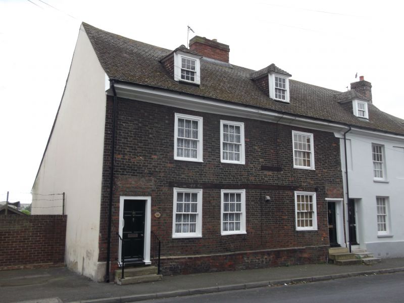
HIGH STREET
1.
5282
(South Side)
Queenborough
Nos 83 to 91 (odd)
TQ 9072 SE 1/52 19.10.51.
II GV
2.
A group of early C18 houses. 2 storeys and attics. Brick or stucco. 5 hipped
dormers. Moulded eaves cornice. 5 original sash windows in exposed frames.
3 blanks and 1 altered window. No 83 has a later C19 shopfront. Single doorcase
to No 89 with a 6-panelled door, the top 2 panels cut away and glazed. Nos
89 and 91 have a fine brick plinth and band.
Listing NGR: TQ9090772261
External links are from the relevant listing authority and, where applicable, Wikidata. Wikidata IDs may be related buildings as well as this specific building. If you want to add or update a link, you will need to do so by editing the Wikidata entry.


Other nearby listed buildings
