Approximate Location Map
Large Map »
Latitude: 52.639 / 52°38'20"N
Longitude: -2.4916 / 2°29'29"W
OS Eastings: 366831
OS Northings: 304697
OS Grid: SJ668046
Mapcode National: GBR BW.6TK1
Mapcode Global: WH9D8.PXQR
Plus Code: 9C4VJGQ5+J9
Entry Name: The Rookery
Listing Date: 9 August 1974
Grade: II
Source: Historic England
Source ID: 1367418
English Heritage Legacy ID: 361988
ID on this website: 101367418
Location: Coalbrookdale, Telford and Wrekin, Shropshire, TF8
County: Telford and Wrekin
Civil Parish: The Gorge
Built-Up Area: Telford
Traditional County: Shropshire
Lieutenancy Area (Ceremonial County): Shropshire
Church of England Parish: Coalbrookdale
Church of England Diocese: Hereford
Tagged with: Architectural structure
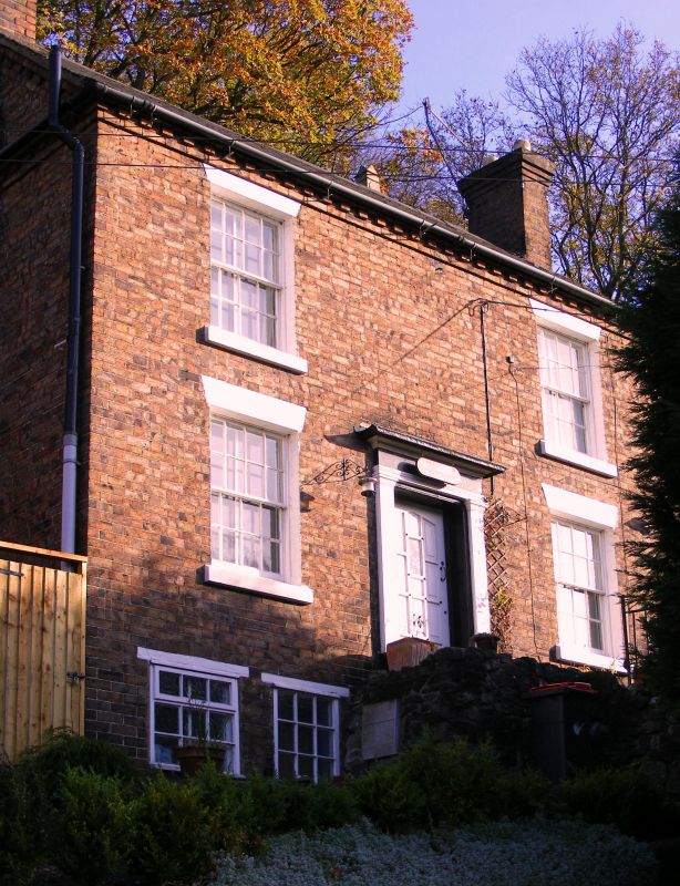
COALBROOKDALE WELLINGTON ROAD
1.
5362 (east side)
No 13 (The Rookery)
SJ 6604 9/125 9.8.74
II GV
2.
Early-mid C19. Brick; 2 storeys; 2 sash windows with plain lintels and stone sills;
wood pilaster doorcase with cornice hood and modern door; modillion eaves; tile roof.
Included for group value.
Listing NGR: SJ6683104697
External links are from the relevant listing authority and, where applicable, Wikidata. Wikidata IDs may be related buildings as well as this specific building. If you want to add or update a link, you will need to do so by editing the Wikidata entry.


Other nearby listed buildings
