Approximate Location Map
Large Map »
Latitude: 51.7549 / 51°45'17"N
Longitude: -1.2504 / 1°15'1"W
OS Eastings: 451840
OS Northings: 206513
OS Grid: SP518065
Mapcode National: GBR 8YY.W4R
Mapcode Global: VHCXV.85V0
Plus Code: 9C3WQP3X+XV
Entry Name: Gatepiers Between Numbers 7 and 8
Listing Date: 28 June 1972
Grade: II
Source: Historic England
Source ID: 1369393
English Heritage Legacy ID: 245552
ID on this website: 101369393
Location: Oxford, Oxfordshire, OX1
County: Oxfordshire
District: Oxford
Electoral Ward/Division: Holywell
Parish: Non Civil Parish
Built-Up Area: Oxford
Traditional County: Oxfordshire
Lieutenancy Area (Ceremonial County): Oxfordshire
Church of England Parish: Oxford St Mary the Virgin with St Cross with St Peter-in-the-East,
Church of England Diocese: Oxford
Tagged with: Gatepost
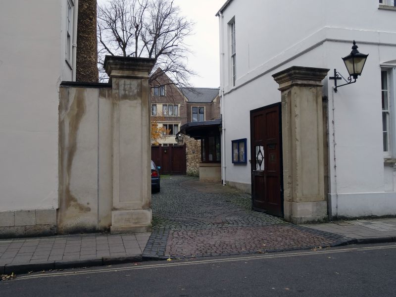
HOLYWELL STREET
1.
1485
(North Side)
Gatepiers between
Nos 7 & 8
SP 5106 NE 6/219B
II GV
2.
C18. Ashlar piers with moulded caps.
All the listed buildings on the North Side form a group.
Listing NGR: SP5184006513
External links are from the relevant listing authority and, where applicable, Wikidata. Wikidata IDs may be related buildings as well as this specific building. If you want to add or update a link, you will need to do so by editing the Wikidata entry.


Other nearby listed buildings
