Approximate Location Map
Large Map »
Latitude: 55.348 / 55°20'52"N
Longitude: -1.6122 / 1°36'43"W
OS Eastings: 424690
OS Northings: 606060
OS Grid: NU246060
Mapcode National: GBR K65L.RQ
Mapcode Global: WHC1T.6VK1
Plus Code: 9C7W89XQ+54
Entry Name: Masons Arms
Listing Date: 31 December 1969
Last Amended: 1 September 1988
Grade: II
Source: Historic England
Source ID: 1371233
English Heritage Legacy ID: 237183
Also known as: Masons Arms, Morpeth
ID on this website: 101371233
Location: Warkworth, Northumberland, NE65
County: Northumberland
Civil Parish: Warkworth
Built-Up Area: Warkworth
Traditional County: Northumberland
Lieutenancy Area (Ceremonial County): Northumberland
Church of England Parish: Warkworth St Lawrence
Church of England Diocese: Newcastle
Tagged with: Pub
NU 2406
21/292
31.12.69
WARKW0RTH
DIAL PLACE
(West side)
Mason's Arms
(formerly listed as No 3 Mason's Arms)
GV
II
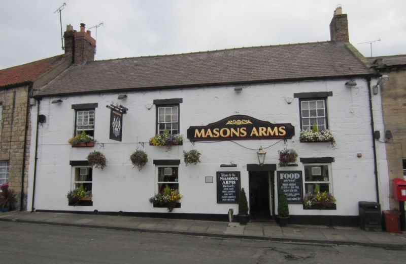
Inn. C17 or earlier, altered C18 and early C19. Lower part of front rendered,
upper part squared stone, all cream-washed; rear elevation rubble, partly
rendered, except for north-west wing squared stone. Welsh slate roofs with
brick stacks.
2 storeys, 3 irregular bays. Between right bays old door of 6 fielded panels.
Ground floor plain sash windows, with 12-pane sashes above. Coped gables on
moulded kneelers; old banded left end stack, rebuilt right end stack.
Rear elevation: Centre bay has 2-light mullioned windows (upper lost mullion)
and steep coped gable with worn finial cross. Left projecting wing with two
12-pane sashes on 1st floor and hipped roof.
Interior: ground floor has old transverse beams, one with painted inscription
'On the 8th of Oct 1715 the EARL OF DERWENTWATER & 40 of his followers Dined
in this HOUSE'.
Flat-roofed single-storey parts at rear are not of interest.
Listing NGR: NU2469006060
External links are from the relevant listing authority and, where applicable, Wikidata. Wikidata IDs may be related buildings as well as this specific building. If you want to add or update a link, you will need to do so by editing the Wikidata entry.


Other nearby listed buildings
