Approximate Location Map
Large Map »
Latitude: 52.6281 / 52°37'41"N
Longitude: -2.4802 / 2°28'48"W
OS Eastings: 367593
OS Northings: 303478
OS Grid: SJ675034
Mapcode National: GBR BW.7J3Z
Mapcode Global: WH9DG.W64K
Plus Code: 9C4VJGH9+6W
Entry Name: 1 and 2, St Lukes Road
Listing Date: 9 August 1974
Grade: II
Source: Historic England
Source ID: 1374362
English Heritage Legacy ID: 362205
ID on this website: 101374362
Location: Ironbridge, Telford and Wrekin, Shropshire, TF8
County: Telford and Wrekin
Civil Parish: The Gorge
Built-Up Area: Telford
Traditional County: Shropshire
Lieutenancy Area (Ceremonial County): Shropshire
Church of England Parish: Ironbridge
Church of England Diocese: Hereford
Tagged with: Building
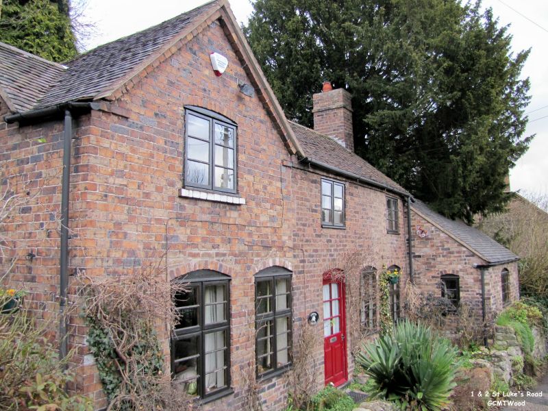
IRONBRIDGE ST LUKES ROAD
1.
5362 Nos 1 and 2
SJ 6703 14/349 9.8.74
II GV
2.
Early C19. A pair of simple cottages. Red brick. Two storeys; 3 plain casement
windows, the lowers with cambered heads; small gable on left-hand side; 2 plain
doorways with ledged doors and with weather hood to No 2. Old tile roof.
Listing NGR: SJ6759303478
External links are from the relevant listing authority and, where applicable, Wikidata. Wikidata IDs may be related buildings as well as this specific building. If you want to add or update a link, you will need to do so by editing the Wikidata entry.


Other nearby listed buildings
