Approximate Location Map
Large Map »
Latitude: 52.6279 / 52°37'40"N
Longitude: -2.4859 / 2°29'9"W
OS Eastings: 367209
OS Northings: 303454
OS Grid: SJ672034
Mapcode National: GBR BW.7GQQ
Mapcode Global: WH9DG.S6FR
Plus Code: 9C4VJGH7+4M
Entry Name: 8, Tontine Hill
Listing Date: 9 August 1974
Grade: II
Source: Historic England
Source ID: 1374363
English Heritage Legacy ID: 362213
ID on this website: 101374363
Location: Ironbridge, Telford and Wrekin, Shropshire, TF8
County: Telford and Wrekin
Civil Parish: The Gorge
Built-Up Area: Telford
Traditional County: Shropshire
Lieutenancy Area (Ceremonial County): Shropshire
Church of England Parish: Ironbridge
Church of England Diocese: Hereford
Tagged with: Building
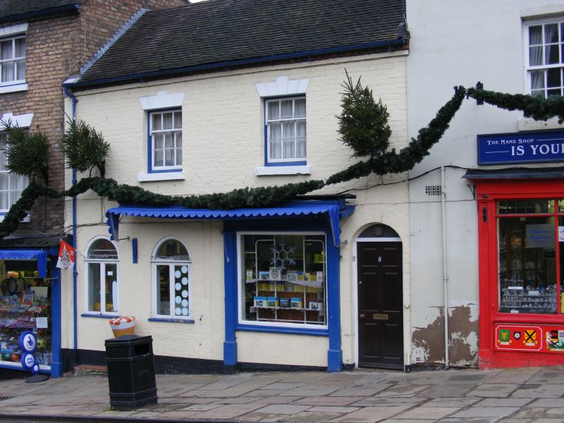
IRONBRIDGE TONTINE HILL
1.
5362 No 8
SJ 6703 SW 15/358 9.8.74
II GV
2.
Early C19 with later alterations. Painted brick; 2 storeys; 2 windows with
channelled lintels and modern casements; dentilled brick eaves; old tile roof.
Mid C19 small shopfront with arched doorway and modern window on right. Included
for group value.
Listing NGR: SJ6720903454
External links are from the relevant listing authority and, where applicable, Wikidata. Wikidata IDs may be related buildings as well as this specific building. If you want to add or update a link, you will need to do so by editing the Wikidata entry.


Other nearby listed buildings
