Approximate Location Map
Large Map »
Latitude: 52.6284 / 52°37'42"N
Longitude: -2.4878 / 2°29'16"W
OS Eastings: 367076
OS Northings: 303517
OS Grid: SJ670035
Mapcode National: GBR BW.7G75
Mapcode Global: WH9DG.R6HB
Plus Code: 9C4VJGH6+9V
Entry Name: 11, the Wharfage
Listing Date: 9 August 1974
Grade: II
Source: Historic England
Source ID: 1374367
English Heritage Legacy ID: 362231
ID on this website: 101374367
Location: Ironbridge, Telford and Wrekin, Shropshire, TF8
County: Telford and Wrekin
Civil Parish: The Gorge
Built-Up Area: Telford
Traditional County: Shropshire
Lieutenancy Area (Ceremonial County): Shropshire
Church of England Parish: Ironbridge
Church of England Diocese: Hereford
Tagged with: Building
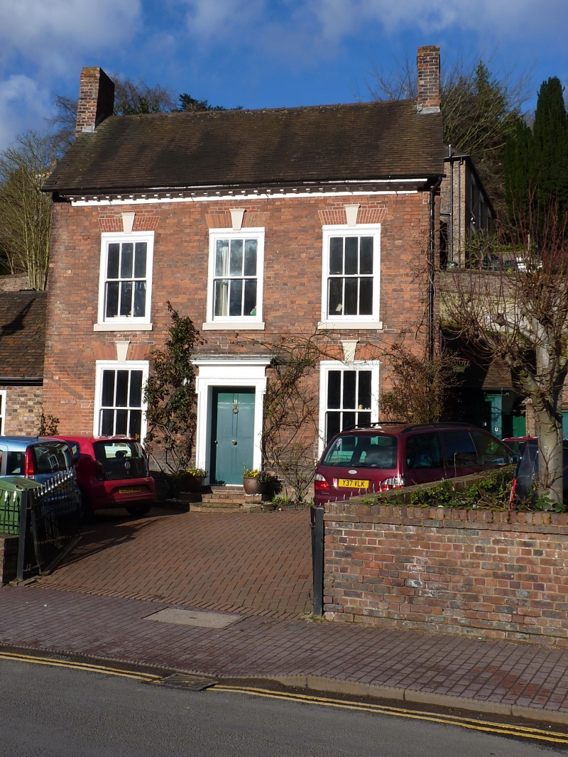
IRONBRIDGE THE WHARFAGE
1.5362
(north side)
No 11
SJ 6703 SW 15/377 9.8.74
II GV
2.
C18. Red brick; 2 storeys; 3 sash windows with flush frames, keyblocks and flat
brick arches; wood pilaster doorcase with part-glazed panelled door; end brick
stacks; and tiled roof.
Listing NGR: SJ6707603517
External links are from the relevant listing authority and, where applicable, Wikidata. Wikidata IDs may be related buildings as well as this specific building. If you want to add or update a link, you will need to do so by editing the Wikidata entry.


Other nearby listed buildings
