Approximate Location Map
Large Map »
Latitude: 52.6276 / 52°37'39"N
Longitude: -2.4845 / 2°29'4"W
OS Eastings: 367304
OS Northings: 303427
OS Grid: SJ673034
Mapcode National: GBR BW.7H32
Mapcode Global: WH9DG.T63Y
Plus Code: 9C4VJGH8+26
Entry Name: 33, High Street
Listing Date: 9 August 1974
Grade: II
Source: Historic England
Source ID: 1374906
English Heritage Legacy ID: 362163
ID on this website: 101374906
Location: Ironbridge, Telford and Wrekin, Shropshire, TF8
County: Telford and Wrekin
Civil Parish: The Gorge
Built-Up Area: Telford
Traditional County: Shropshire
Lieutenancy Area (Ceremonial County): Shropshire
Church of England Parish: Ironbridge
Church of England Diocese: Hereford
Tagged with: Building
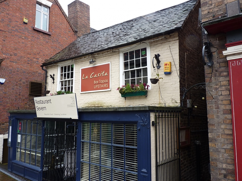
IRONBRIDGE HIGH STREET
1.
5362 No 33
SJ 6703 SW 15/305 9.8.74
II GV
2.
Late C18 or early C19. Painted brick front. Two storeys. Two sash windows in
broad frames. Modillion eaves; tiled roof. Modern projecting shop fronts to ground
storey.
Listing NGR: SJ6730403427
External links are from the relevant listing authority and, where applicable, Wikidata. Wikidata IDs may be related buildings as well as this specific building. If you want to add or update a link, you will need to do so by editing the Wikidata entry.


Other nearby listed buildings
