Approximate Location Map
Large Map »
Latitude: 51.4337 / 51°26'1"N
Longitude: -0.7735 / 0°46'24"W
OS Eastings: 485356
OS Northings: 171236
OS Grid: SU853712
Mapcode National: GBR D7M.380
Mapcode Global: VHDX3.J7Y8
Plus Code: 9C3XC6MG+FJ
Entry Name: Pitts Bridge
Listing Date: 20 December 1972
Grade: II
Source: Historic England
Source ID: 1390274
English Heritage Legacy ID: 489256
ID on this website: 101390274
Location: Binfield Park, Bracknell Forest, Berkshire, RG42
County: Bracknell Forest
Civil Parish: Binfield
Traditional County: Berkshire
Lieutenancy Area (Ceremonial County): Berkshire
Church of England Parish: Binfield
Church of England Diocese: Oxford
Tagged with: Bridge
BINFIELD
SU87SE FOREST ROAD
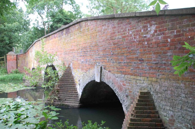
674-1/12/64 Pitts Bridge
20/12/72
GV II
Road bridge. Early C19. Brick in Flemish bond, with weathered
stone coping. 3 brick arches with stone keystones. V-shaped
cutwaters. Spiral ends to parapet wall with piers and stone
caps.
External links are from the relevant listing authority and, where applicable, Wikidata. Wikidata IDs may be related buildings as well as this specific building. If you want to add or update a link, you will need to do so by editing the Wikidata entry.


Other nearby listed buildings
