Approximate Location Map
Large Map »
Latitude: 51.3826 / 51°22'57"N
Longitude: -2.3615 / 2°21'41"W
OS Eastings: 374938
OS Northings: 164897
OS Grid: ST749648
Mapcode National: GBR 0QH.9RD
Mapcode Global: VH96M.0HXZ
Plus Code: 9C3V9JMQ+2C
Entry Name: 12, Trim Street
Listing Date: 11 August 1972
Last Amended: 15 October 2010
Grade: II
Source: Historic England
Source ID: 1395396
English Heritage Legacy ID: 510803
ID on this website: 101395396
Location: Bath, Bath and North East Somerset, Somerset, BA1
County: Bath and North East Somerset
Parish: Non Civil Parish
Built-Up Area: Bath
Traditional County: Somerset
Lieutenancy Area (Ceremonial County): Somerset
Church of England Parish: Bath St Michael Without
Church of England Diocese: Bath and Wells
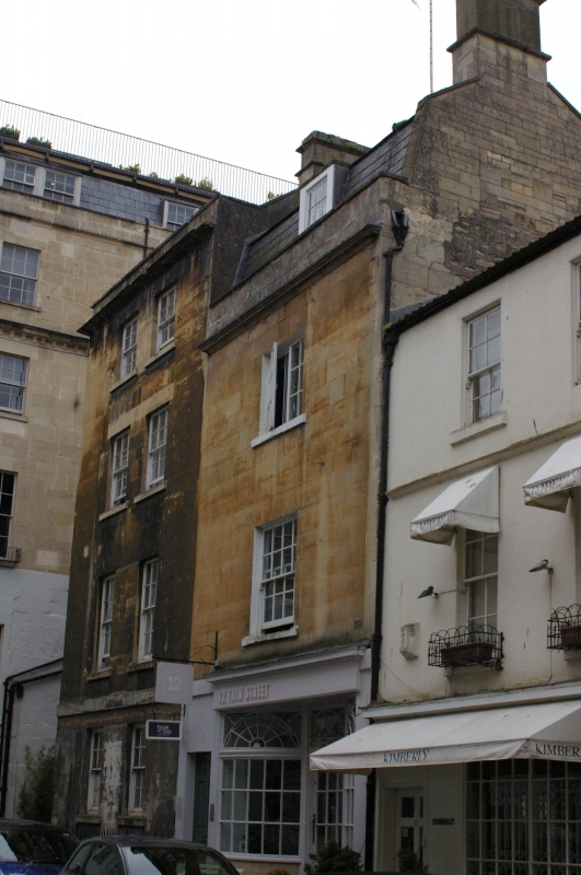
TRIM STREET
656-1/40/1698 (South side)
No.12
(Formerly Listed as:
TRIM STREET (South side)
Nos 11-14 (consec)
including No.12A)
11/08/72
GV II
House in row, with shop. Late C18 or early C19 with C20 additions.
MATERIALS: Limestone ashlar, rubble to rear, roof not visible, deep plain ridged, low pitch.
EXTERIOR: Three storeys with basement, one window front, two-light small-pane casement above sixteen-pane sash, both to plain reveals. Ground floor has late C20 recessed shopfront with bowed small pane display windows and central door under decorative transom lights, to left six-panel door on single step, and in plat raised surround. Remains of platband above ground floor, cornice with blocking course and parapet, stack to right. Rear has cornice and parapet in ashlar above rubble with dressed quoins, in two bays with staggered eight-pane sashes. Ground floor of building extended to rear, and has entry from small graveyard by medieval city wall (qv).
INTERIOR: Not inspected.
HISTORY: The street was laid out in 1707, on land owned by George Trim, just outside the mediaeval walls, but this building is a later replacement. The Street retains its flagged pavements and sett roadway.
Listing NGR: ST7493864897
External links are from the relevant listing authority and, where applicable, Wikidata. Wikidata IDs may be related buildings as well as this specific building. If you want to add or update a link, you will need to do so by editing the Wikidata entry.


Other nearby listed buildings
