Approximate Location Map
Large Map »
Latitude: 55.4281 / 55°25'41"N
Longitude: -5.5405 / 5°32'25"W
OS Eastings: 176078
OS Northings: 620614
OS Grid: NR760206
Mapcode National: IRL Y3.S9BT
Mapcode Global: GBR DGPC.JXN
Plus Code: 9C7PCFH5+6Q
Entry Name: Davaar Lighthouse
Listing Name: Davaar Lighthouse
Listing Date: 28 August 1980
Category: B
Source: Historic Scotland
Source ID: 336233
Historic Scotland Designation Reference: LB4920
Building Class: Cultural
ID on this website: 200336233
Location: Campbeltown
County: Argyll and Bute
Electoral Ward: South Kintyre
Parish: Campbeltown
Traditional County: Argyllshire
Tagged with: Lighthouse
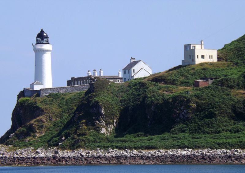
1854. Short tower, circular on plan. Lime-washed, small
piended building near base. KEEPERS' HOUSES:
1-storey row. Rubble Platform roof. BOUNDARY WALL limewashed.
Unmanned, became an automatic lighthouse in 1983
External links are from the relevant listing authority and, where applicable, Wikidata. Wikidata IDs may be related buildings as well as this specific building. If you want to add or update a link, you will need to do so by editing the Wikidata entry.


