Approximate Location Map
Large Map »
Latitude: 57.318 / 57°19'4"N
Longitude: -5.6764 / 5°40'35"W
OS Eastings: 178730
OS Northings: 831254
OS Grid: NG787312
Mapcode National: GBR D9CC.W4G
Mapcode Global: WH0B0.SB48
Plus Code: 9C9P889F+6C
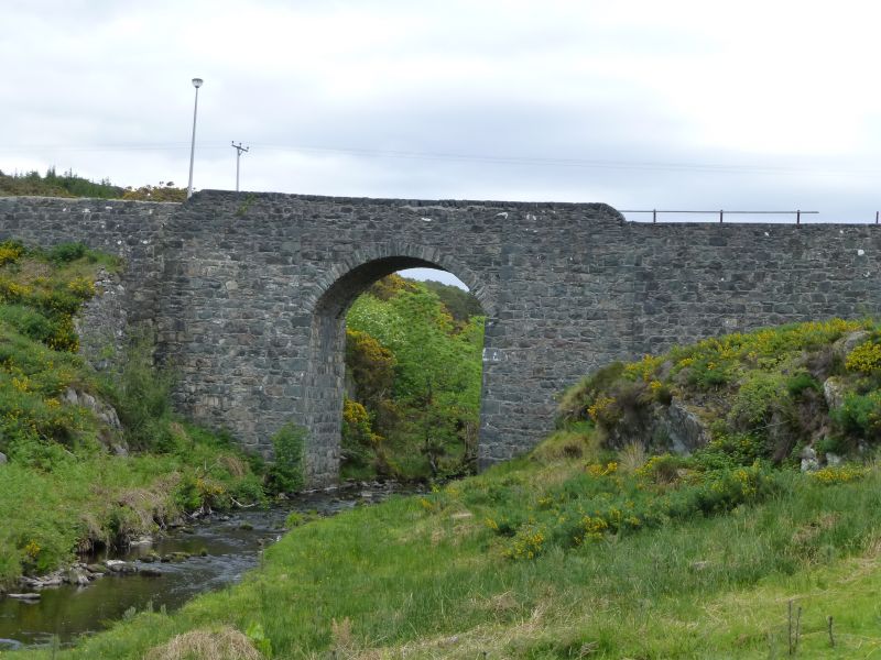
Entry Name: Bridge, Duirinish
Listing Name: Duirinish Bridge over Allt Duirinish
Listing Date: 8 September 1982
Category: C
Source: Historic Scotland
Source ID: 338769
Historic Scotland Designation Reference: LB7003
Building Class: Cultural
ID on this website: 200338769
Location: Lochalsh
County: Highland
Electoral Ward: Wester Ross, Strathpeffer and Lochalsh
Parish: Lochalsh
Traditional County: Ross-shire
Tagged with: Road bridge
1826. Tall, single arched bridge, rubble with roughly dressed
rubble facings. Single stilted arch ring; shallow flanking
buttresses; rubble cope; turf copes to approach abutments.
External links are from the relevant listing authority and, where applicable, Wikidata. Wikidata IDs may be related buildings as well as this specific building. If you want to add or update a link, you will need to do so by editing the Wikidata entry.


Other nearby listed buildings
