Approximate Location Map
Large Map »
Latitude: 56.0316 / 56°1'53"N
Longitude: -3.7611 / 3°45'40"W
OS Eastings: 290352
OS Northings: 683475
OS Grid: NS903834
Mapcode National: GBR 1L.RT6F
Mapcode Global: WH5QT.6N7G
Plus Code: 9C8R26JQ+JG
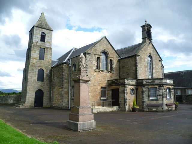
Entry Name: Bothkennar Parish Church
Listing Name: Bothkennar Parish Church.
Listing Date: 25 October 1972
Category: B
Source: Historic Scotland
Source ID: 340415
Historic Scotland Designation Reference: LB8310
Building Class: Cultural
ID on this website: 200340415
Location: Grangemouth
County: Falkirk
Electoral Ward: Carse, Kinnaird and Tryst
Parish: Grangemouth
Traditional County: Stirlingshire
Tagged with: Church building
1789. Tower 1792 enlarged 1887. Symmetrical facade I shaped
plan.
Ecclesiastical building in use as such.
External links are from the relevant listing authority and, where applicable, Wikidata. Wikidata IDs may be related buildings as well as this specific building. If you want to add or update a link, you will need to do so by editing the Wikidata entry.


Other nearby listed buildings
