Approximate Location Map
Large Map »
Latitude: 57.5286 / 57°31'42"N
Longitude: -4.5461 / 4°32'46"W
OS Eastings: 247642
OS Northings: 851570
OS Grid: NH476515
Mapcode National: GBR H84T.QBC
Mapcode Global: WH3F0.41FC
Plus Code: 9C9QGFH3+CG
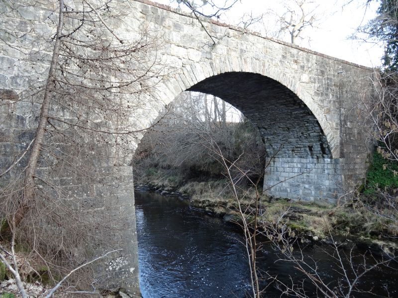
Entry Name: Orrin Bridge, Aultgowrie
Listing Name: Orrin Bridge over River Orrain at Aultgowrie
Listing Date: 31 August 1983
Category: B
Source: Historic Scotland
Source ID: 347277
Historic Scotland Designation Reference: LB14020
Building Class: Cultural
Also known as: Aultgowrie, Orrin Bridge
ID on this website: 200347277
Location: Urray
County: Highland
Electoral Ward: Wester Ross, Strathpeffer and Lochalsh
Parish: Urray
Traditional County: Ross-shire
Tagged with: Bridge Road bridge Stone arch bridge
Mid 19th century; high, single span bridge; coursed rubble,
dressed rubble arch ring; ashlar coped parapet with shaped
terminals; splayed approach; shallow end buttresses.
External links are from the relevant listing authority and, where applicable, Wikidata. Wikidata IDs may be related buildings as well as this specific building. If you want to add or update a link, you will need to do so by editing the Wikidata entry.


Other nearby listed buildings
