Approximate Location Map
Large Map »
Latitude: 56.0583 / 56°3'29"N
Longitude: -3.8807 / 3°52'50"W
OS Eastings: 282982
OS Northings: 686643
OS Grid: NS829866
Mapcode National: GBR 1F.QB51
Mapcode Global: WH4PF.CZ8J
Plus Code: 9C8R3459+8P
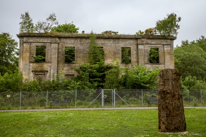
Entry Name: Plean House
Listing Name: Plean House
Listing Date: 6 September 1979
Category: C
Source: Historic Scotland
Source ID: 348832
Historic Scotland Designation Reference: LB15281
Building Class: Cultural
ID on this website: 200348832
Location: St Ninians
County: Stirling
Electoral Ward: Bannockburn
Parish: St Ninians
Traditional County: Stirlingshire
Tagged with: Country house
Classical c 1820.
Doric columned porch. 2 storey on raised basement. 5 attic
dormers. Doric pillasters on front elevation.
Derelict
External links are from the relevant listing authority and, where applicable, Wikidata. Wikidata IDs may be related buildings as well as this specific building. If you want to add or update a link, you will need to do so by editing the Wikidata entry.


Other nearby listed buildings
