Approximate Location Map
Large Map »
Latitude: 56.2582 / 56°15'29"N
Longitude: -2.6259 / 2°37'33"W
OS Eastings: 361323
OS Northings: 707476
OS Grid: NO613074
Mapcode National: GBR 2Y.9Q0L
Mapcode Global: WH8TL.MYSR
Plus Code: 9C8V795F+7M
Entry Name: Crail Castle
Listing Name: Crail Castle
Listing Date: 9 May 1972
Category: B
Source: Historic Scotland
Source ID: 359147
Historic Scotland Designation Reference: LB23401
Building Class: Cultural
ID on this website: 200359147
Location: Crail
County: Fife
Town: Crail
Electoral Ward: East Neuk and Landward
Traditional County: Fife
Tagged with: Castle
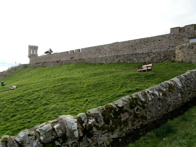
Perhaps 13th century, fragmentary remains of royal castle; historic associations.
External links are from the relevant listing authority and, where applicable, Wikidata. Wikidata IDs may be related buildings as well as this specific building. If you want to add or update a link, you will need to do so by editing the Wikidata entry.


Other nearby listed buildings
