Approximate Location Map
Large Map »
Latitude: 56.1863 / 56°11'10"N
Longitude: -2.819 / 2°49'8"W
OS Eastings: 349263
OS Northings: 699597
OS Grid: NT492995
Mapcode National: GBR 2Q.G8LV
Mapcode Global: WH7SR.NRTW
Plus Code: 9C8V55PJ+G9
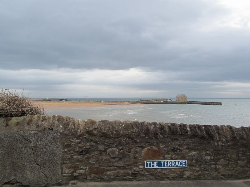
Entry Name: Elie Harbour
Listing Name: Elie Harbour
Listing Date: 18 August 1972
Category: B
Source: Historic Scotland
Source ID: 372111
Historic Scotland Designation Reference: LB30937
Building Class: Cultural
ID on this website: 200372111
Location: Elie and Earlsferry
County: Fife
Town: Elie And Earlsferry
Electoral Ward: East Neuk and Landward
Traditional County: Fife
Tagged with: Harbour
Rebuilt between 1854 and 1864 for Mr Baird of Elie. Tidal, stugged ashlar; cast-iron bollards.
External links are from the relevant listing authority and, where applicable, Wikidata. Wikidata IDs may be related buildings as well as this specific building. If you want to add or update a link, you will need to do so by editing the Wikidata entry.


Other nearby listed buildings
