Approximate Location Map
Large Map »
Latitude: 55.1519 / 55°9'6"N
Longitude: -2.9977 / 2°59'51"W
OS Eastings: 336515
OS Northings: 584623
OS Grid: NY365846
Mapcode National: GBR 78HW.S0
Mapcode Global: WH7YP.XRPW
Plus Code: 9C7V5222+PW
Entry Name: Old Parish Church And Burial-Ground, Langholm
Listing Name: Langholm Old Churchyard
Listing Date: 3 August 1971
Category: C
Source: Historic Scotland
Source ID: 382154
Historic Scotland Designation Reference: LB37136
Building Class: Cultural
ID on this website: 200382154
Location: Langholm
County: Dumfries and Galloway
Town: Langholm
Electoral Ward: Annandale East and Eskdale
Traditional County: Dumfriesshire
Tagged with: Church building Cemetery
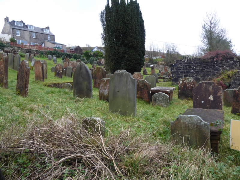
Burial grund occupying steeply sloping roughly square area, rubble-walled, and enclosing mainly 18th and 19th century
headstones, ruined fragments of early 18th century parish
church with margined openings and rusticated quoins.
Gateway on NW wall to Alma Place.
Change of Category B to C(S) 12.7.88.
External links are from the relevant listing authority and, where applicable, Wikidata. Wikidata IDs may be related buildings as well as this specific building. If you want to add or update a link, you will need to do so by editing the Wikidata entry.


Other nearby listed buildings
