Approximate Location Map
Large Map »
Latitude: 56.3966 / 56°23'47"N
Longitude: -3.4272 / 3°25'37"W
OS Eastings: 312002
OS Northings: 723620
OS Grid: NO120236
Mapcode National: GBR 1Z.0XPN
Mapcode Global: WH6QC.BH74
Plus Code: 9C8R9HWF+J4
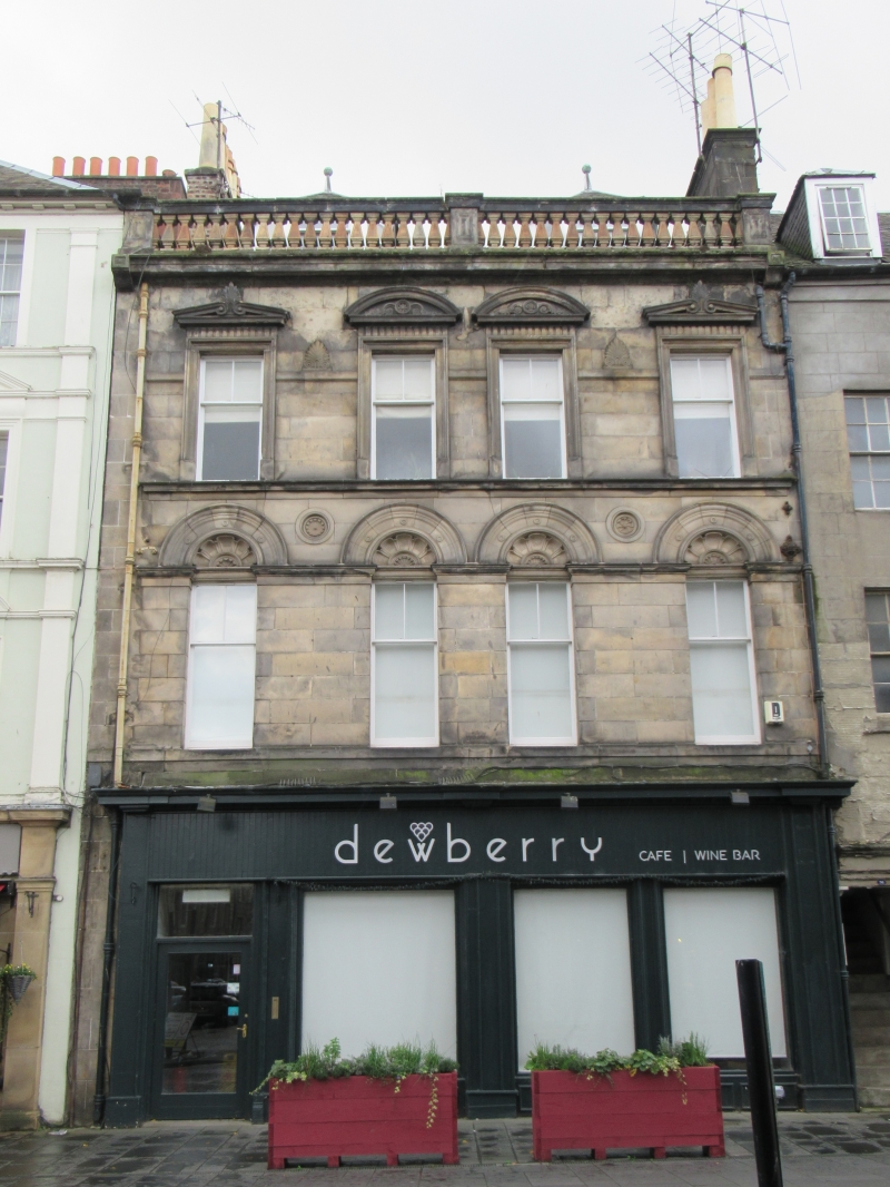
Entry Name: 32, 34, 36 And 36A High Street, Perth
Listing Name: High Street 32, 34, 36 and 36A (S Side)
Listing Date: 26 August 1977
Category: B
Source: Historic Scotland
Source ID: 385138
Historic Scotland Designation Reference: LB39471
Building Class: Cultural
ID on this website: 200385138
Location: Perth
County: Perth and Kinross
Town: Perth
Electoral Ward: Perth City Centre
Traditional County: Perthshire
Tagged with: Architectural structure
Late 19th century, 3-storey and attic with ground floor
shops, ashlar: 4-window front, arched with decorative tympana
at 1st, pediments at 2nd balustraded parapet 2 canted dormers
with ball finials; slated roof.
External links are from the relevant listing authority and, where applicable, Wikidata. Wikidata IDs may be related buildings as well as this specific building. If you want to add or update a link, you will need to do so by editing the Wikidata entry.


Other nearby listed buildings
