Approximate Location Map
Large Map »
Latitude: 56.2125 / 56°12'44"N
Longitude: -2.7261 / 2°43'33"W
OS Eastings: 355063
OS Northings: 702448
OS Grid: NO550024
Mapcode National: GBR 2T.DKJF
Mapcode Global: WH7ST.334R
Plus Code: 9C8V676F+XH
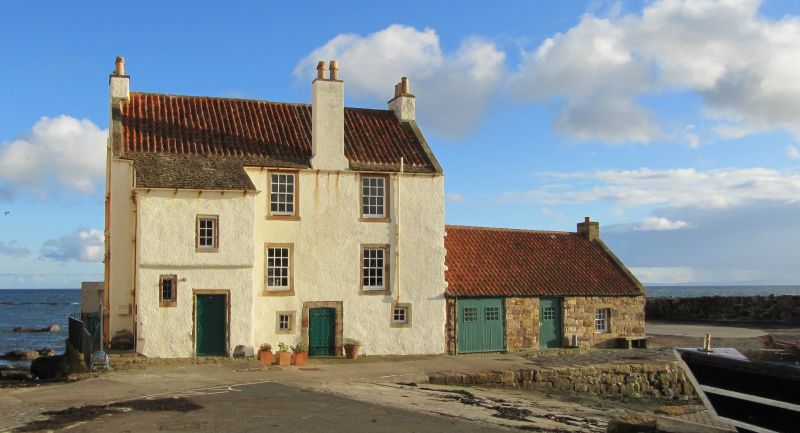
Entry Name: Gyles House, 6 The Gyles, Pittenweem
Listing Name: Gyles House
Listing Date: 18 August 1972
Category: A
Source: Historic Scotland
Source ID: 385839
Historic Scotland Designation Reference: LB39959
Building Class: Cultural
ID on this website: 200385839
Location: Pittenweem
County: Fife
Town: Pittenweem
Electoral Ward: East Neuk and Landward
Traditional County: Fife
Tagged with: House
1626 and later, large sea-captain's house 3-storey, front stair outshot with moulded openings, harled with margins, pantiled part slated. Crowstepped 2-storey back wing, rubble and pantile outbuilding.
External links are from the relevant listing authority and, where applicable, Wikidata. Wikidata IDs may be related buildings as well as this specific building. If you want to add or update a link, you will need to do so by editing the Wikidata entry.


Other nearby listed buildings
