Approximate Location Map
Large Map »
Latitude: 56.3393 / 56°20'21"N
Longitude: -2.7926 / 2°47'33"W
OS Eastings: 351097
OS Northings: 716613
OS Grid: NO510166
Mapcode National: GBR 2R.4GKG
Mapcode Global: WH7S0.2XGK
Plus Code: 9C8V86Q4+PX
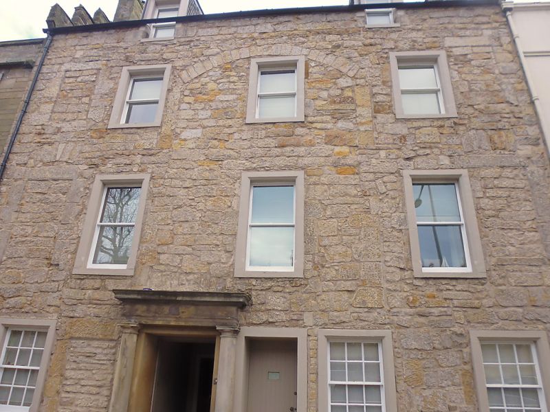
Entry Name: 52 South Street, St Andrews
Listing Name: 52 South Street, with Garden Walls of Lang Rig, Including Those Now Belonging to Abbey Close and Red Roofs.
Listing Date: 28 April 1959
Category: B
Source: Historic Scotland
Source ID: 386641
Historic Scotland Designation Reference: LB40680
Building Class: Cultural
ID on this website: 200386641
Location: St Andrews
County: Fife
Town: St Andrews
Electoral Ward: St Andrews
Traditional County: Fife
Tagged with: House
16th to 18th cents. 3-storey, 3-window; stucco with margins,
Roman doric pilastered doorpiece, large 16th cent. gableted
crowsteps with Monypenny arms on skewputt; slated; vaulted
cellars, bow-fronted harled wing with venetian window to
back.
External links are from the relevant listing authority and, where applicable, Wikidata. Wikidata IDs may be related buildings as well as this specific building. If you want to add or update a link, you will need to do so by editing the Wikidata entry.


Other nearby listed buildings
