Approximate Location Map
Large Map »
Latitude: 56.1081 / 56°6'29"N
Longitude: -3.877 / 3°52'37"W
OS Eastings: 283365
OS Northings: 692181
OS Grid: NS833921
Mapcode National: GBR 1F.M4ZJ
Mapcode Global: WH4P7.FQ1T
Plus Code: 9C8R445F+66
Entry Name: Bridge, Old Polmaise
Listing Name: Fallin, Polmaise Estate, Bridge at NS 8337 9218
Listing Date: 22 December 1997
Category: B
Source: Historic Scotland
Source ID: 391668
Historic Scotland Designation Reference: LB44928
Building Class: Cultural
ID on this website: 200391668
Location: St Ninians
County: Stirling
Electoral Ward: Bannockburn
Parish: St Ninians
Traditional County: Stirlingshire
Tagged with: Bridge
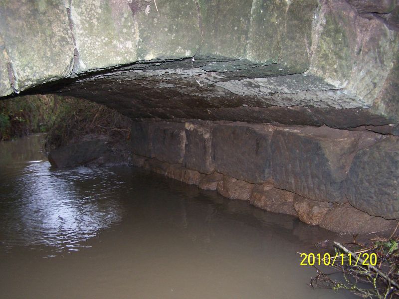
Probably circa 1790. Small road bridge over narrow burn leading from River Forth. Squared and stugged sandstone with wing walls curved in plan and swept down from centre, voussoired arch ring and coped wallhead.
The form of the bridge is similar to that used on a larger scale for canal work in the late 18th century. The bridge lies to the south of Benny's Bridge.
External links are from the relevant listing authority and, where applicable, Wikidata. Wikidata IDs may be related buildings as well as this specific building. If you want to add or update a link, you will need to do so by editing the Wikidata entry.


Other nearby listed buildings
