Approximate Location Map
Large Map »
Latitude: 53.1627 / 53°9'45"N
Longitude: -3.4713 / 3°28'16"W
OS Eastings: 301730
OS Northings: 363853
OS Grid: SJ017638
Mapcode National: GBR 6K.4P8P
Mapcode Global: WH65W.NR6S
Plus Code: 9C5R5G7H+3F
Entry Name: Segrwyd Mill and Mill House
Listing Date: 19 July 1966
Last Amended: 15 December 1998
Grade: II
Source: Cadw
Source ID: 814
Building Class: Industrial
ID on this website: 300000814
Location: Located at the northern boundary of the community, on the SE side of the Afon Ystrad; on the NE side of a lane running NW from the road running SE from Denbigh to Nantglyn.
County: Denbighshire
Town: Denbigh
Community: Nantglyn
Community: Nantglyn
Locality: Segrwyd Mill
Traditional County: Denbighshire
Tagged with: House
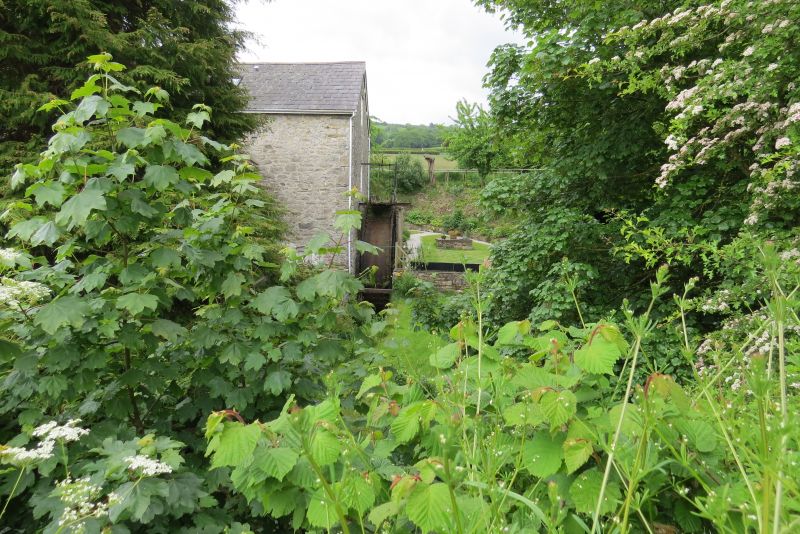
Water mill first mentioned in 1572. In that year Robert Dudley, Earl of Leicester and Baron Denbigh, granted Hugh Rosindale, alias Lloyd, a license to build 'a mill on the river Ystrad under Segroit park'. The present mill and associated mill house are probably late C18; the mill was in use until 1959.
Late Georgian corn mill with adjoining mill-house. Of limestone rubble construction with renewed slate roofs of large slates; plain modern bargeboards and oversailing verges. The mill section is a rectangular gabled block of two-and-a-half storeys, with the gable facing the lane. Wide entrance to the ground floor at L, with segmentally-arched head and rough-dressed limestone voussoirs; modern boarded doors. To the R is a 9-pane window (modern replacement of original) with cambered head. The first floor has a pair of similar windows with C19 9-pane glazing; in the gable apex is an original 30-pane horizontal sliding sash. Large iron overshot water-wheel to the rear, of approximately 4m diameter; paddles missing; wooden launder carried on stone pier from leat above. The first floor has an unglazed loading bay with a 12-pane sliding sash above. The L side (SE) has a sliding sash of 12- and 6-pane sections to the first floor, with a boarded loading bay to the R, both with cambered heads; pegged frame to the latter. A single-storey brick and corrugated iron lean-to adjoins to the L.
The mill-house adjoins to the R and is both stepped-down and slightly set-back. Of 2 storeys and 2 windows, with central entrance via modern stone and slate porch; modern door. The flanking windows on both floors are 9-pane modern windows in cambered openings, as before; plain squat chimney to the R. To the rear is a large 9-pane modern window with modern part-glazed door to the R; modern glazing to 2 first-floor windows.
The milling machinery survives largely intact. Slate-flagged ground floor with plain beamed ceiling and inclined ladder access to first floor at L. The main wheel shaft is partitioned off to the rear and its associated horizontal and vertical toothed wheels remain complete; no visible foundry plates. There are 3 pairs of grinding stones with hoppers to the first floor, each with a corresponding flour bin below. The attic floor is accessed via an inclined ladder, as before, and has a grinding wheel (for tools), operated by a belt pulley from the main shaft. 3-bay roof structure with open framed trusses of queen post type; replaced rafters and roof.
Listed for its special interest as a well-preserved C18 water mill and mill-house group retaining its machinery.
External links are from the relevant listing authority and, where applicable, Wikidata. Wikidata IDs may be related buildings as well as this specific building. If you want to add or update a link, you will need to do so by editing the Wikidata entry.


Other nearby listed buildings
