Approximate Location Map
Large Map »
Latitude: 52.4136 / 52°24'48"N
Longitude: -4.0859 / 4°5'9"W
OS Eastings: 258228
OS Northings: 281558
OS Grid: SN582815
Mapcode National: GBR 8R.P4LY
Mapcode Global: VH4FC.4LBL
Plus Code: 9C4QCW77+CM
Entry Name: Julias Restaurant
Listing Date: 24 November 1987
Last Amended: 24 November 1987
Grade: II
Source: Cadw
Source ID: 10191
Building Class: Commercial
ID on this website: 300010191
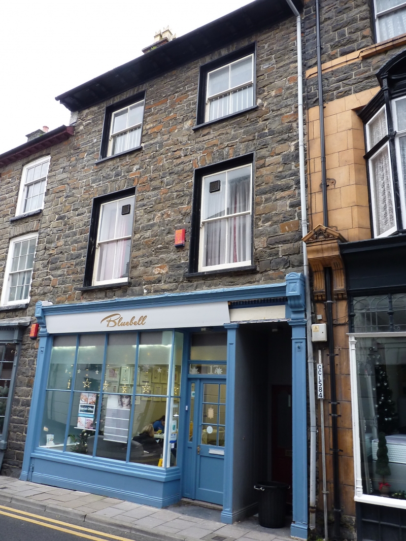
Location: Near the top of the street, stepped up from Nos 17 and 19 adjoining to the left.
County: Ceredigion
Community: Aberystwyth
Community: Aberystwyth
Built-Up Area: Aberystwyth
Traditional County: Cardiganshire
Tagged with: Building
Shown on ca.1790 map.
3-storey, 2-window coursed rubble front, in pat bonded in to No 17 to left; slate roof and modillion eaves. Sash windows without glazing bars; overall Victorian shop front with dentil cornice, fascia ends and panelled stallriser; half glazed restaurant entrance and recessed boarded entrance to right.
Included for group value.
External links are from the relevant listing authority and, where applicable, Wikidata. Wikidata IDs may be related buildings as well as this specific building. If you want to add or update a link, you will need to do so by editing the Wikidata entry.


Other nearby listed buildings
