Approximate Location Map
Large Map »
Latitude: 53.1841 / 53°11'2"N
Longitude: -3.0229 / 3°1'22"W
OS Eastings: 331743
OS Northings: 365711
OS Grid: SJ317657
Mapcode National: GBR 74.3J6Q
Mapcode Global: WH88C.J7RB
Plus Code: 9C5R5XMG+JV
Entry Name: Base of Former Village Pump
Listing Date: 16 November 1994
Last Amended: 16 November 1994
Grade: II
Source: Cadw
Source ID: 15066
Building Class: Gardens, Parks and Urban Spaces
ID on this website: 300015066
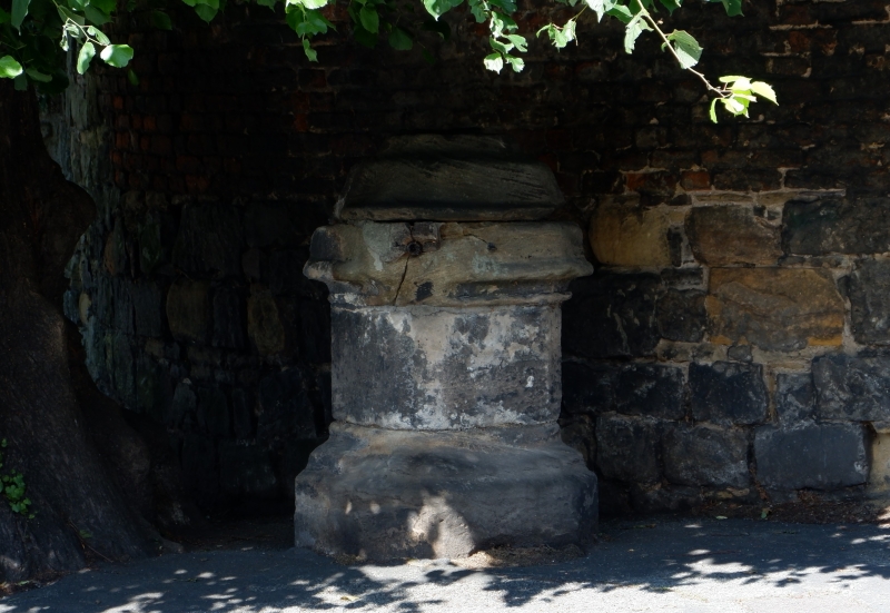
Location: Located in front of the House of Correction in Cross Tree Lane, and beside the Cross Tree, a lime tree planted in 1742.
County: Flintshire
Community: Hawarden (Penarlâg)
Community: Hawarden
Built-Up Area: Sandycroft
Traditional County: Flintshire
Tagged with: Architectural structure
The base of the village pump, probably mid C19. A squat sandstone pillar with chamfered corners and moulded base. Moulded capital and shaped cap. This pump stands on the site of one of two village crosses destroyed in 1641. It was in regular use until 1886.
Group value with the House of Correction.
External links are from the relevant listing authority and, where applicable, Wikidata. Wikidata IDs may be related buildings as well as this specific building. If you want to add or update a link, you will need to do so by editing the Wikidata entry.


Other nearby listed buildings
