Approximate Location Map
Large Map »
Latitude: 52.9718 / 52°58'18"N
Longitude: -3.0913 / 3°5'28"W
OS Eastings: 326813
OS Northings: 342160
OS Grid: SJ268421
Mapcode National: GBR 71.JZK0
Mapcode Global: WH785.HK6M
Plus Code: 9C4RXWC5+PF
Entry Name: Wood Bank
Listing Date: 11 June 1998
Last Amended: 11 June 1998
Grade: II
Source: Cadw
Source ID: 19970
Building Class: Domestic
ID on this website: 300019970
Location: Situated on hillside between B5434 and Llangollen Canal, overlooking the Dee valley and Pont Cysyllte. Although the rear of house is built tight against the canal bank the gardens at front have been
County: Wrexham
Town: Llangollen
Community: Llangollen Rural (Llangollen Wledig)
Community: Llangollen Rural
Locality: Trevor
Built-Up Area: Trevor
Traditional County: Denbighshire
Tagged with: Building
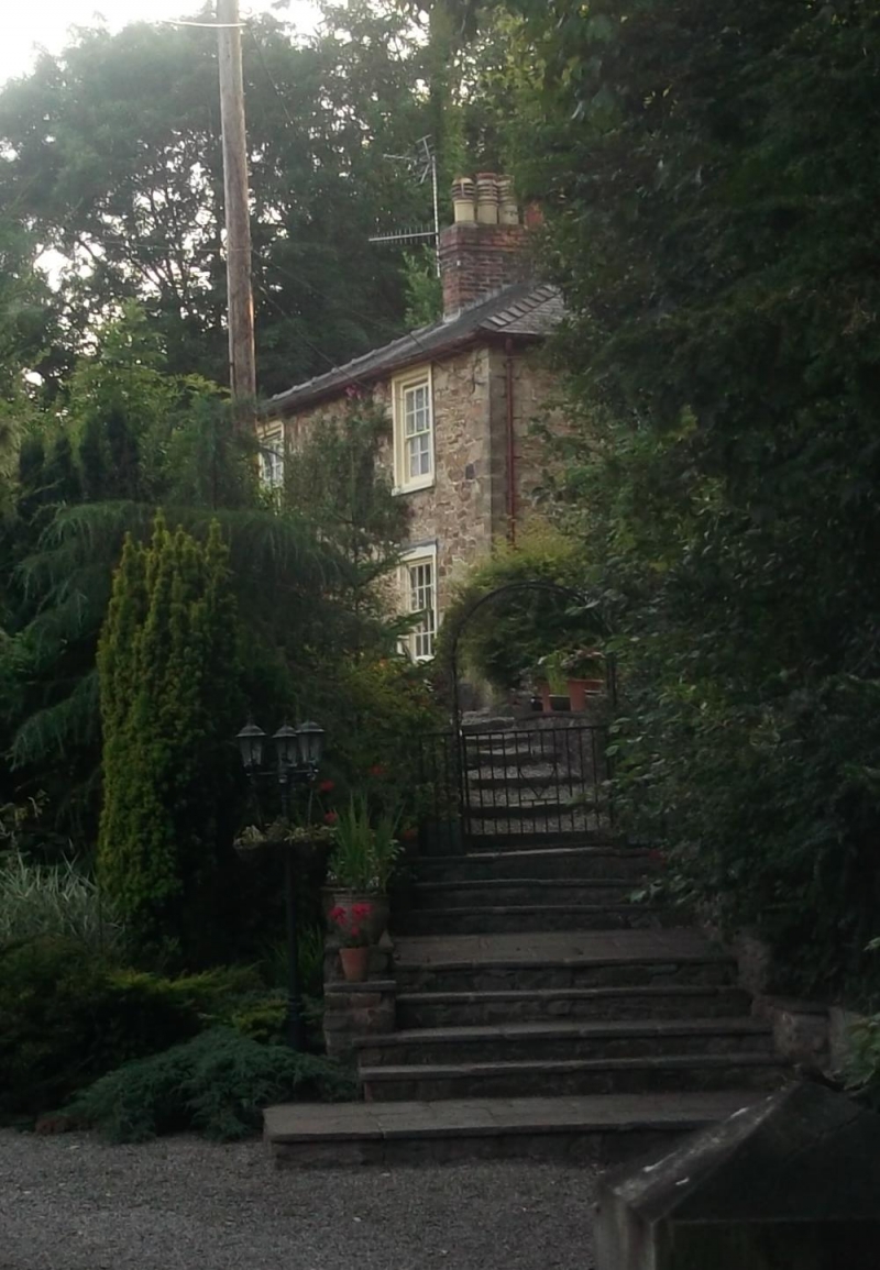
Late C18 house. Reputed to be Telford's drawing office during construction of Ellesmere Canal (renamed Llangollen Canal, 1963) and Pontcysyllte Acqueduct (1795-1805). The constricted space between rear of house and canal bank suggests that the house was built before the final line of the Llangollen Feeder (1804-08) had been determined. Shown on 1838 Tithe Map as 'house and offices, malt kiln and croft', owned by Ellesmere Canal Company and occupied by Thomas Butterton. The malt-house, on site below and SE of house, has been demolished.
Georgian-style 2-storey, double-fronted house in local rubble stone with tooled ashlar quoins. Lowish pitch, hipped and slated roof with overhanging eaves and central, red-brick chimney-stack. 16-pane horned sash lower windows with wood surrounds (upper parts replaced) to symmetrical front elevation; upper windows, 16-pane to W and 12-pane to E; central doorway with wood surround and double, 3-panelled doors. Later single-storey extension to W incorporates stone pillars which may have belonged to original entrance porch. Plain side elevations. 2-storey rear wing with lower roof built in two phases at right angles to main block. Corners of later phase of rear wing are chamfered. Curved bread oven at E junction between two phases of rear wing. Later single-storey lean-to extension to W of rear wing.
Symmetrical plan with small entrance lobby backing on to central chimney-stack. Stairs at rear of chimney-stack. Living Room to W has wood-boarded floor and plain plaster ceiling; Dining Room to E has wood-boarded floor and timber joist ceiling; both rooms with wood-surrounded fireplaces backing on to each other. Original kitchen has quarry tiled floor, timber joist ceiling and wide-arched fireplace with original grating. Bread oven opens off rear extension.
Listed as a fine and well-preserved example of late Georgian villa-type house.
External links are from the relevant listing authority and, where applicable, Wikidata. Wikidata IDs may be related buildings as well as this specific building. If you want to add or update a link, you will need to do so by editing the Wikidata entry.


Other nearby listed buildings
