Approximate Location Map
Large Map »
Latitude: 52.9014 / 52°54'4"N
Longitude: -4.5683 / 4°34'5"W
OS Eastings: 227355
OS Northings: 336860
OS Grid: SH273368
Mapcode National: GBR 54.P6RD
Mapcode Global: WH44F.SBTK
Plus Code: 9C4QWC2J+HM
Entry Name: Lychgate and churchyard wall to Church of St Tudwen
Listing Date: 15 July 1998
Last Amended: 15 July 1998
Grade: II
Source: Cadw
Source ID: 20130
Building Class: Religious, Ritual and Funerary
ID on this website: 300020130
Location: Isolated walled churchyard by Llandudwen farm, approached by drive running N off lane about 1.3 km W of Madryn Castle.
County: Gwynedd
Town: Pwllheli
Community: Buan
Community: Buan
Locality: Llandudwen
Traditional County: Caernarfonshire
Tagged with: Lychgate
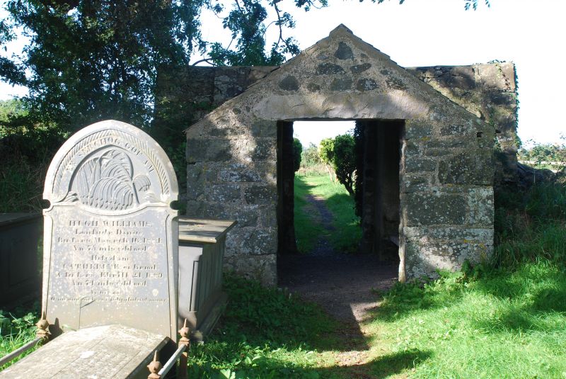
Lychgate and surrounding walls of uncertain date to rectangular churchyard of Llandudwen church. The church was rebuilt in the C16 to C17, the lychgate could be C17.
Lychgate and churchyard walls. Continuous rubble stone boundary wall to rectangular churchyard, with rough stone coping. Walled entry path to W with a mounting stone inscribed Garreg Farch at the far end. Lychgate, of rubble stone, has plain flat-topped W side and slated gabled roofed building behind with E square headed doorway and stone lintel.
Included for group value with Church of St Tudwen.
External links are from the relevant listing authority and, where applicable, Wikidata. Wikidata IDs may be related buildings as well as this specific building. If you want to add or update a link, you will need to do so by editing the Wikidata entry.


Other nearby listed buildings
