History in Structure

Lychgate and Steps to St Stephen's Church

A Grade II Listed Building in Bodfari, Denbighshire

More Photos »
Approximate Location Map
Large Map »

Coordinates

Latitude: 53.2201 / 53°13'12"N

Longitude: -3.3609 / 3°21'39"W

OS Eastings: 309234

OS Northings: 370090

OS Grid: SJ092700

Mapcode National: GBR 6Q.1042

Mapcode Global: WH76W.BBV8

Plus Code: 9C5R6JCQ+2M

Entry Name: Lychgate and Steps to St Stephen's Church

Listing Date: 16 November 1962

Last Amended: 12 April 2002

Grade: II

Source: Cadw

Source ID: 26481

Building Class: Religious, Ritual and Funerary

ID on this website: 300026481

Location: To the south-west of St Stephen's Church

County: Denbighshire

Community: Bodfari

Community: Bodfari

Locality: Bodfari Village

Traditional County: Flintshire

Tagged with: Lychgate

Find accommodation in
Bodfari

History

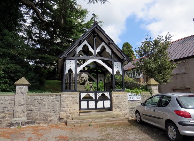
The flight of steps connecting the village with the church must originate with the church, but when the church was rebuilt in 1865 to the design of T. H. Wyatt he designed the lychgate and the rebuild of the steps.

Exterior

A lightly constructed timber-framed lychgate of two bays, with gables to front and rear. Slate roof overhanging at verges, with surviving iron finial at rear. The timber frame is painted black, with Gothic inserts painted white. Iron-spiked timber gates at front. Side seats. Flagged paving.

At the rear there are steps rising to the church, in two flights with a landing between. Stone posts and rails to the sides, also seats at each side of the landing.

Reasons for Listing

Listed for group value with St Stephen's Church, and as a feature in a village centre of conservation importance.

External Links

External links are from the relevant listing authority and, where applicable, Wikidata. Wikidata IDs may be related buildings as well as this specific building. If you want to add or update a link, you will need to do so by editing the Wikidata entry.

Recommended Books

Other nearby listed buildings

  • II Dinorben Arms Public House
    Immediately south of St. Stephen's Church. The house is sited downslope. Extensive carparks at rear.
  • II Hafod-tan-yr-eglwys (Formerly Ty-gwyn)
    Immediately west of St. Stephen's Church, on a site raised above the roads of the village. Rubble limestone wall to front with iron gate.
  • II* Church of St Stephen
    At the centre of Bodfari Village, approached by a lychgate and long flight of steps. The orientation of the church is north east, but conventional orientation is assumed in this description. Stone chu
  • II The Old School and Schoolhouse
    At the east fringe of Bodfari Village, reached by a track to the north of the B5429, and occupying a terraced site on the hillside with extensive views south. Stone wall at north, with two gateways. P
  • II Geinas Farmhouse
    At north side of the A541, ½ km south of Bodfari Parish Church. Small walled garden at front, other enclosed ground at sides and rear. Farmyard on opposite side of road.
  • II Barn at Aberwheeler House
    To the north of Aberwheeler House
  • II Aberwheeler House
    Reached by a narrow lane ½ km north-east of Pont Geinas, located in private grounds. Set of bee-boles to east, old brick barn to north.
  • II Bee-boles at Aberwheeler House
    At north-west corner of the garden to the rear of Aberwheeler House

BritishListedBuildings.co.uk is an independent online resource and is not associated with any government department. All government data published here is used under licence. Please do not contact BritishListedBuildings.co.uk for any queries related to any individual listed building, planning permission related to listed buildings or the listing process itself.

British Listed Buildings is a Good Stuff website.