Approximate Location Map
Large Map »
Latitude: 51.5861 / 51°35'10"N
Longitude: -3.1157 / 3°6'56"W
OS Eastings: 322794
OS Northings: 188066
OS Grid: ST227880
Mapcode National: GBR J0.CBZ5
Mapcode Global: VH6DV.YD6D
Plus Code: 9C3RHVPM+FP
Entry Name: Churchyard cross at the Church of St Michael
Listing Date: 1 March 1963
Last Amended: 22 August 2003
Grade: II
Source: Cadw
Source ID: 81792
ID on this website: 300081792
Location: In the churchyard just to the S of the Church of Saint Michael.
County: Newport
Town: Newport
Community: Graig
Community: Graig
Locality: Lower Machen
Traditional County: Monmouthshire
Tagged with: Christian cross
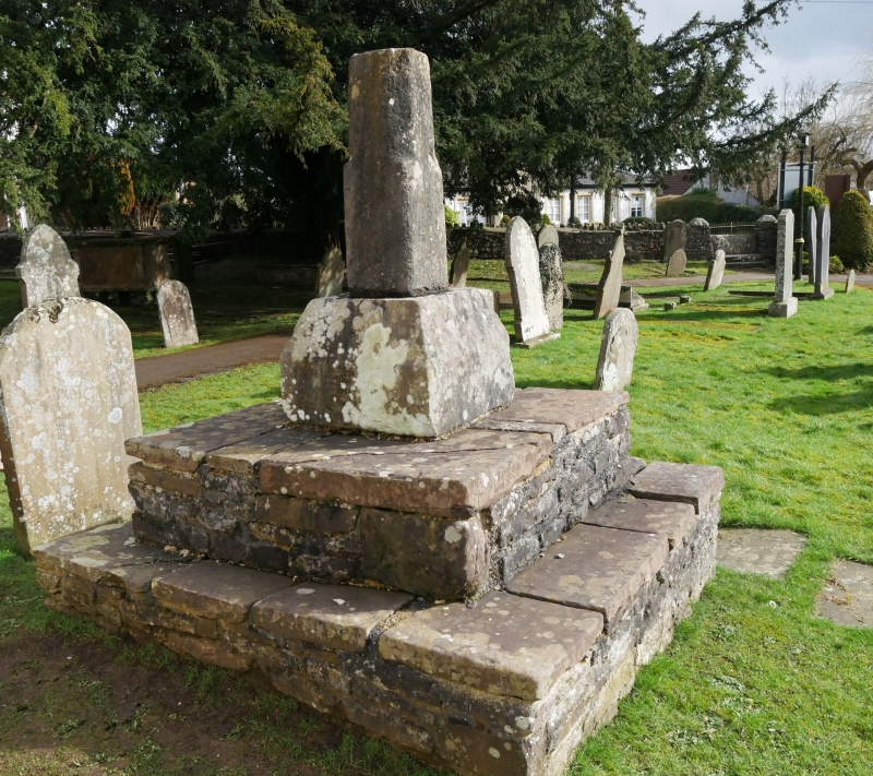
Base of medieval churchyard cross on stepped plinth.
Square cross base with steep chamfer to top carrying lowest section of shaft, square broached to octagonal. Set on 2 renewed rubble stone steps.
Included as the remains of a late medieval churchyard cross.
External links are from the relevant listing authority and, where applicable, Wikidata. Wikidata IDs may be related buildings as well as this specific building. If you want to add or update a link, you will need to do so by editing the Wikidata entry.


Other nearby listed buildings
