Approximate Location Map
Large Map »
Latitude: 51.7025 / 51°42'9"N
Longitude: -2.9006 / 2°54'2"W
OS Eastings: 337859
OS Northings: 200803
OS Grid: SO378008
Mapcode National: GBR J9.3YYC
Mapcode Global: VH79V.NGXP
Plus Code: 9C3VP33X+2Q
Entry Name: Matthews Tomb in St Mary's Churchyard
Listing Date: 30 April 2004
Last Amended: 30 April 2004
Grade: II
Source: Cadw
Source ID: 82764
ID on this website: 300082764
Location: On S side of churchyard between Church Street gates and church.
County: Monmouthshire
Town: Usk
Community: Usk (Brynbuga)
Community: Usk
Built-Up Area: Usk
Traditional County: Monmouthshire
Tagged with: Tomb
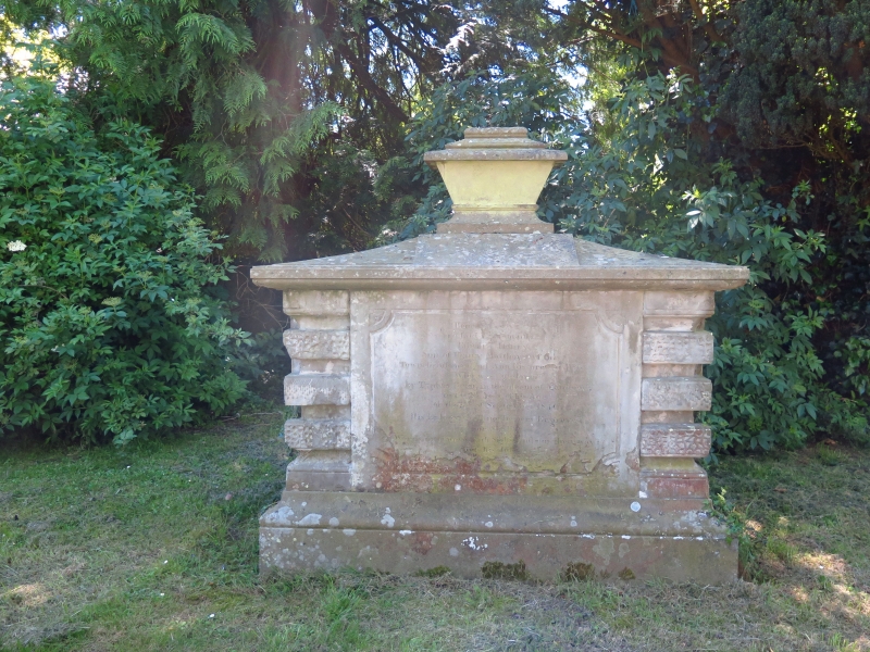
Early C19, commemorating death of Edward Henry Matthews in 1840.
Fine chest tomb with Classical detailing. Rectangular chest on plinth has heavy vermiculated and glacial quoins. Capstone supports rectangular urn.
Inscription in memory of Edward Henry Matthews "cut down by typhus fever" at age of 21 in 1840.
Strongly designed early C19 chest tomb. Group value with adjacent listed church and churchyard walls.
External links are from the relevant listing authority and, where applicable, Wikidata. Wikidata IDs may be related buildings as well as this specific building. If you want to add or update a link, you will need to do so by editing the Wikidata entry.


Other nearby listed buildings
