Approximate Location Map
Large Map »
Latitude: 50.3511 / 50°21'4"N
Longitude: -3.5812 / 3°34'52"W
OS Eastings: 287601
OS Northings: 51330
OS Grid: SX876513
Mapcode National: GBR QS.R9KD
Mapcode Global: FRA 38D3.LMY
Plus Code: 9C2R9C29+FG
Entry Name: 37 and 39, Victoria Road
Listing Date: 23 October 1972
Last Amended: 23 February 1994
Grade: II
Source: Historic England
Source ID: 1197591
English Heritage Legacy ID: 387388
ID on this website: 101197591
Location: Dartmouth, South Hams, Devon, TQ6
County: Devon
District: South Hams
Civil Parish: Dartmouth
Built-Up Area: Dartmouth
Traditional County: Devon
Lieutenancy Area (Ceremonial County): Devon
Church of England Parish: Dartmouth Townstal
Church of England Diocese: Exeter
Tagged with: Building
DARTMOUTH
SX874510 VICTORIA ROAD
673-1/8/276 (South side)
23/10/72 Nos.37 AND 39
(Formerly Listed as:
VICTORIA ROAD
(South side)
Nos.35-41 (Odd))
GV II
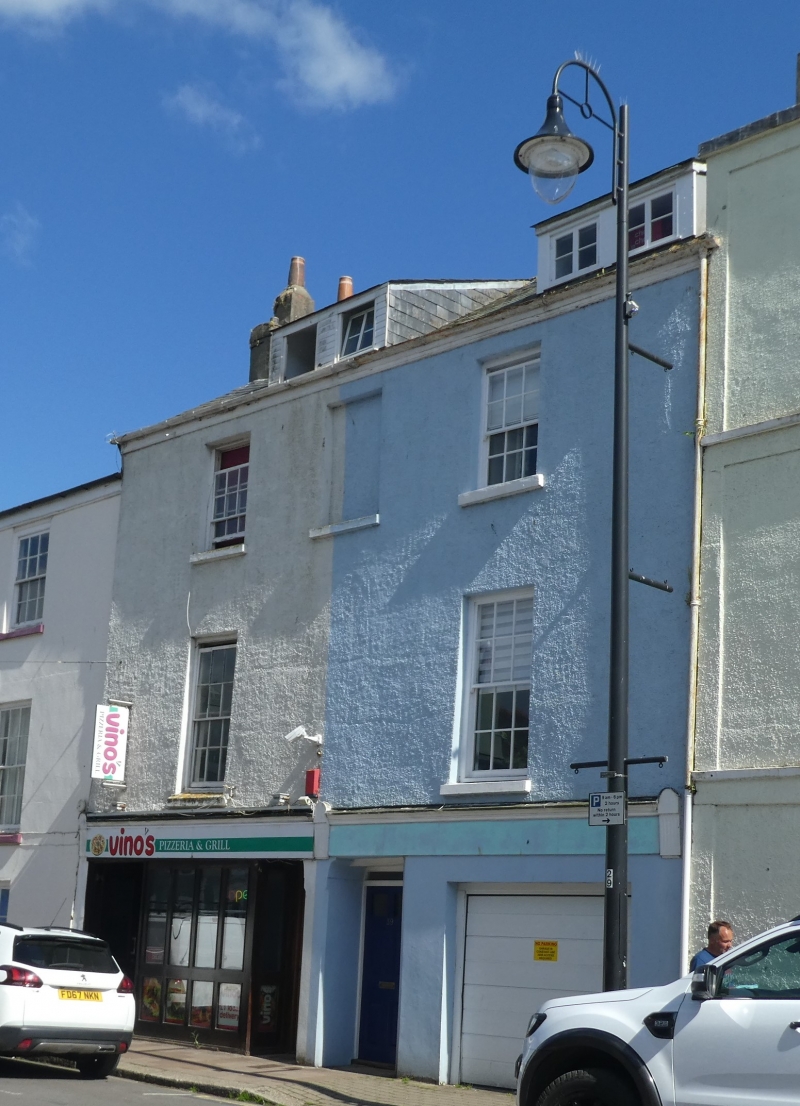
Pair of contemporary houses. Mid C19, shops inserted on ground
floor in late C19/early C20. Roughcast stone rubble; stone
rubble end stacks with plastered brick chimneyshafts with old
pots; slate roof.
PLAN: Double-depth, each a mirror plan of the other with
central entrance passages.
EXTERIOR: 3 storeys with attics; symmetrical 3-window
roughcast front. Paired central doorways to houses containing
recessed top-glazed 6-panel doors with narrow overlights.
Left-hand shop front modernised in the C20 and right-hand one
converted to a garage: remains of the late C19/early C20
timber shop front include a continuous fascia across both
houses between end brackets. 12-pane sashes above, those on
the first floor taller than those on the second. No central
window at first-floor level and central blind window to the
second floor. Plain eaves to parallel roof which contains 2
front C20 dormers.
INTERIOR: Not inspected.
This pair of houses is part of a good group of houses and
shops all dating from the second quarter of the C19 alongside
New Road (now Victoria Road) which was built in 1825 to
enable, for the first time, horse-drawn carriages in and out
of the town.
Listing NGR: SX8760151330
External links are from the relevant listing authority and, where applicable, Wikidata. Wikidata IDs may be related buildings as well as this specific building. If you want to add or update a link, you will need to do so by editing the Wikidata entry.


Other nearby listed buildings
