Approximate Location Map
Large Map »
Latitude: 52.7244 / 52°43'27"N
Longitude: -2.4304 / 2°25'49"W
OS Eastings: 371027
OS Northings: 314170
OS Grid: SJ710141
Mapcode National: GBR BY.1JC6
Mapcode Global: WH9CX.MSW8
Plus Code: 9C4VPHF9+QR
Entry Name: 24-28, Wellington Road
Listing Date: 8 April 1983
Grade: II
Source: Historic England
Source ID: 1025008
English Heritage Legacy ID: 362049
ID on this website: 101025008
Location: Muxton, Telford and Wrekin, Shropshire, TF2
County: Telford and Wrekin
Civil Parish: Donnington and Muxton
Built-Up Area: Telford
Traditional County: Shropshire
Lieutenancy Area (Ceremonial County): Shropshire
Church of England Parish: Muxton St John the Evangelist
Church of England Diocese: Lichfield
Tagged with: Building
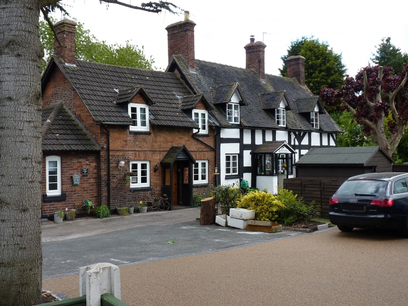
DONNINGTON MUXTON
1.
5362 Wellington Road
(south side)
Nos 24, 26 and 28
SJ 71 SW 29/184
II
2.
C17 timber framed range of cottages. Steeply pitched plain tile roof with gabled
ends. One storey and attic, 3 window range. Casements. Three gabled dormers.
Brick ridge chimney stacks.
Listing NGR: SJ7102714170
External links are from the relevant listing authority and, where applicable, Wikidata. Wikidata IDs may be related buildings as well as this specific building. If you want to add or update a link, you will need to do so by editing the Wikidata entry.


Other nearby listed buildings
