Approximate Location Map
Large Map »
Latitude: 51.0623 / 51°3'44"N
Longitude: 0.3399 / 0°20'23"E
OS Eastings: 564060
OS Northings: 131819
OS Grid: TQ640318
Mapcode National: GBR NS5.8RS
Mapcode Global: FRA C6L9.XXM
Plus Code: 9F32386Q+WX
Entry Name: The White House
Listing Date: 18 April 1973
Grade: II
Source: Historic England
Source ID: 1028099
English Heritage Legacy ID: 296753
ID on this website: 101028099
Location: Sparrow's Green, Wealden, East Sussex, TN5
County: East Sussex
District: Wealden
Civil Parish: Wadhurst
Built-Up Area: Wadhurst
Traditional County: Sussex
Lieutenancy Area (Ceremonial County): East Sussex
Church of England Parish: Wadhurst St Peter and St Paul
Church of England Diocese: Chichester
Tagged with: House
WADHURST CHURCH STREET
1.
5208
(south side)
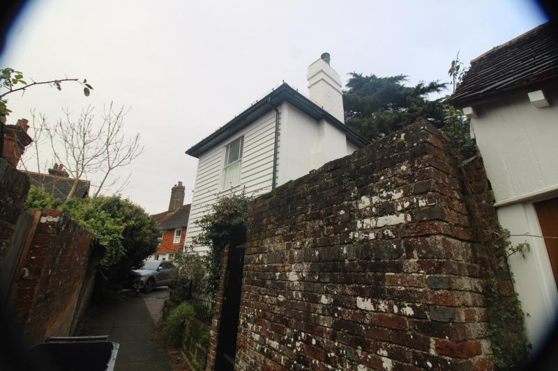
The White House
TQ 6431 37/366 18.4.73
II GV
2.
Small L-shaped early C19 house. Two storeys. One window west and one window
facing south. Faced with weather-boarding. Wide eaves cornice. Hipped slate
roof. Glazing bars missing.
Listing NGR: TQ6406031818
External links are from the relevant listing authority and, where applicable, Wikidata. Wikidata IDs may be related buildings as well as this specific building. If you want to add or update a link, you will need to do so by editing the Wikidata entry.


Other nearby listed buildings
