Approximate Location Map
Large Map »
Latitude: 52.9726 / 52°58'21"N
Longitude: -0.9885 / 0°59'18"W
OS Eastings: 468023
OS Northings: 342167
OS Grid: SK680421
Mapcode National: GBR 9JX.NWQ
Mapcode Global: WHFHZ.SKG1
Plus Code: 9C4XX2F6+2J
Entry Name: The Windmill
Listing Date: 13 November 1986
Grade: II
Source: Historic England
Source ID: 1039576
English Heritage Legacy ID: 431206
ID on this website: 101039576
Location: Rushcliffe, Nottinghamshire, NG13
County: Nottinghamshire
District: Rushcliffe
Civil Parish: Newton
Traditional County: Nottinghamshire
Lieutenancy Area (Ceremonial County): Nottinghamshire
Church of England Parish: Shelford
Church of England Diocese: Southwell and Nottingham
SK 64 SE
1/127
SHELFORD
SHELFORD ROAD
Newton
(north side)
The Windmill
II
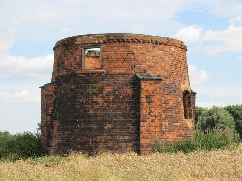
Base of post windmill. Early C19. Red brick. Dogtooth eaves.
Circular-plan, 2 storeys. Buttressed. Ground floor with segmental
arched doorway and single window opening. Above is a single
window opening.
Listing NGR: SK6802342167
External links are from the relevant listing authority and, where applicable, Wikidata. Wikidata IDs may be related buildings as well as this specific building. If you want to add or update a link, you will need to do so by editing the Wikidata entry.


Other nearby listed buildings
