Approximate Location Map
Large Map »
Latitude: 52.2171 / 52°13'1"N
Longitude: -0.8974 / 0°53'50"W
OS Eastings: 475424
OS Northings: 258222
OS Grid: SP754582
Mapcode National: GBR BWG.V8V
Mapcode Global: VHDS5.DJFR
Plus Code: 9C4X6483+R2
Entry Name: The Eleanor Cross
Listing Date: 9 December 1968
Grade: I
Source: Historic England
Source ID: 1039797
English Heritage Legacy ID: 231861
Also known as: Eleanor Cross 1km south west of Delapre Abbey
ID on this website: 101039797
Location: Hardingstone, West Northamptonshire, NN4
County: West Northamptonshire
Electoral Ward/Division: Delapre and Briar Hill
Parish: Far Cotton and Delapre
Built-Up Area: Northampton
Traditional County: Northamptonshire
Lieutenancy Area (Ceremonial County): Northamptonshire
Church of England Parish: Hardingstone St Edmund
Church of England Diocese: Peterborough
Tagged with: Eleanor cross
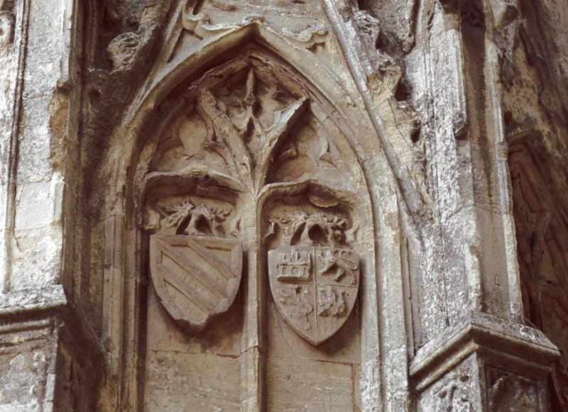
The Eleanor Cross
1.
5327
SP 75 NE 18/137 9.12.68.
I
2.
Scheduled Ancient Monument. Late C13, ashlar with carving. Octagonal plan. Restored
1877.
Listing NGR: SP7542458222
External links are from the relevant listing authority and, where applicable, Wikidata. Wikidata IDs may be related buildings as well as this specific building. If you want to add or update a link, you will need to do so by editing the Wikidata entry.


Other nearby listed buildings
