Approximate Location Map
Large Map »
Latitude: 50.8451 / 50°50'42"N
Longitude: 0.4793 / 0°28'45"E
OS Eastings: 574636
OS Northings: 107997
OS Grid: TQ746079
Mapcode National: GBR PX6.V9X
Mapcode Global: FRA C6WV.Y86
Plus Code: 9F22RFWH+3P
Entry Name: Ruins of the Former Manor House
Listing Date: 11 May 1949
Last Amended: 23 August 1976
Grade: II
Source: Historic England
Source ID: 1044281
English Heritage Legacy ID: 291984
Also known as: Manor of Bexhill
Bishops Palace
Court Lodge
ID on this website: 101044281
Location: Old Town, Rother, East Sussex, TN40
County: East Sussex
District: Rother
Electoral Ward/Division: Old Town
Parish: Bexhill-on-Sea
Built-Up Area: Bexhill
Traditional County: Sussex
Lieutenancy Area (Ceremonial County): East Sussex
Church of England Parish: Bexhill
Church of England Diocese: Chichester
Tagged with: Ruins
1.
5207
TQ 7408 SE
1/21
11.5.49
DE LA WARR ROAD
Old Town
(South Side)
Ruins of the former Manor House
(formerly listed under Hastings Road)
II
2.
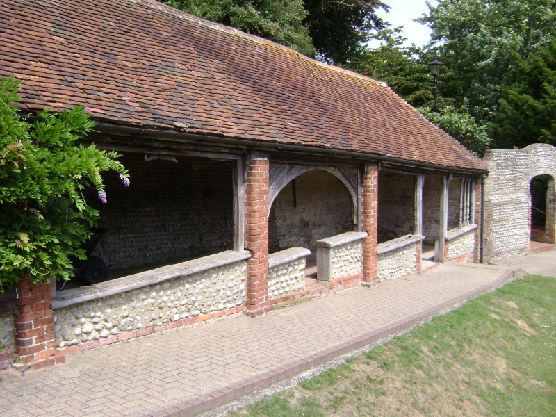
The large house of several periods has been demolished. Incorporated in this were
certain medieval features. Parts of these have been retained and still exist
as a planned ruin in the public garden. These consist of cobbled and stone walls
with stone openings of doorways or windows and 1 fireplace, probably C19.
Listing NGR: TQ7463607997
External links are from the relevant listing authority and, where applicable, Wikidata. Wikidata IDs may be related buildings as well as this specific building. If you want to add or update a link, you will need to do so by editing the Wikidata entry.


Other nearby listed buildings
