Approximate Location Map
Large Map »
Latitude: 51.7537 / 51°45'13"N
Longitude: -1.2517 / 1°15'6"W
OS Eastings: 451750
OS Northings: 206380
OS Grid: SP517063
Mapcode National: GBR 8Z4.2BZ
Mapcode Global: VHCXV.854X
Plus Code: 9C3WQP3X+F8
Entry Name: The Queens College, Boundary Wall on Queens Lane to West of Library
Listing Date: 28 June 1972
Grade: II
Source: Historic England
Source ID: 1046640
English Heritage Legacy ID: 245104
ID on this website: 101046640
Location: Oxford, Oxfordshire, OX1
County: Oxfordshire
District: Oxford
Electoral Ward/Division: Holywell
Parish: Non Civil Parish
Built-Up Area: Oxford
Traditional County: Oxfordshire
Lieutenancy Area (Ceremonial County): Oxfordshire
Church of England Parish: Oxford St Mary the Virgin with St Cross with St Peter-in-the-East,
Church of England Diocese: Oxford
Tagged with: Building
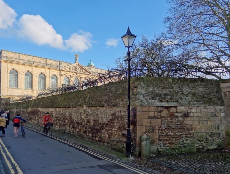
THE QUEEN'S COLLEGE
1.
1485
Boundary wall on Queen's
Lane to West of Library
SP 5106 SE 9/355J
II
2.
C18. Rubble with triangular coping.
Listing NGR: SP5175006380
External links are from the relevant listing authority and, where applicable, Wikidata. Wikidata IDs may be related buildings as well as this specific building. If you want to add or update a link, you will need to do so by editing the Wikidata entry.


Other nearby listed buildings
