Approximate Location Map
Large Map »
Latitude: 51.751 / 51°45'3"N
Longitude: -1.2549 / 1°15'17"W
OS Eastings: 451531
OS Northings: 206074
OS Grid: SP515060
Mapcode National: GBR 8Z4.1KF
Mapcode Global: VHCXV.68F0
Plus Code: 9C3WQP2W+C2
Entry Name: Christchurch, Library
Listing Date: 12 January 1954
Grade: I
Source: Historic England
Source ID: 1046742
English Heritage Legacy ID: 244881
Also known as: Christ Church Library, Oxford
ID on this website: 101046742
Location: Oxford, Oxfordshire, OX1
County: Oxfordshire
District: Oxford
Electoral Ward/Division: Holywell
Parish: Non Civil Parish
Built-Up Area: Oxford
Traditional County: Oxfordshire
Lieutenancy Area (Ceremonial County): Oxfordshire
Tagged with: Library building College library
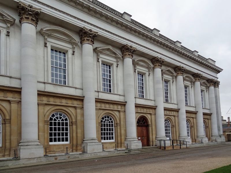
CHRISTCHURCH
1.
1485
Library
SP 5106 SE 9/453D 12.1.54.
I
2.
1716-61 by Dr George Clarke (1661-1736), William Townesend being mason,
in Headington and Burford (Taynton) stone; part of entablature renewed 1894.
Refaced in Portland and Clipsham stone 1960-2.
Listing NGR: SP5153006076
External links are from the relevant listing authority and, where applicable, Wikidata. Wikidata IDs may be related buildings as well as this specific building. If you want to add or update a link, you will need to do so by editing the Wikidata entry.


Other nearby listed buildings
