Approximate Location Map
Large Map »
Latitude: 51.729 / 51°43'44"N
Longitude: -1.2399 / 1°14'23"W
OS Eastings: 452595
OS Northings: 203639
OS Grid: SP525036
Mapcode National: GBR 8ZB.KBT
Mapcode Global: VHCXV.GSDX
Plus Code: 9C3WPQH6+J3
Entry Name: Old Iffley Lock
Listing Date: 28 June 1972
Grade: II
Source: Historic England
Source ID: 1047190
English Heritage Legacy ID: 245663
ID on this website: 101047190
Location: Iffley, Oxford, Oxfordshire, OX4
County: Oxfordshire
District: Oxford
Electoral Ward/Division: Rose Hill and Iffley
Parish: Non Civil Parish
Built-Up Area: Oxford
Traditional County: Oxfordshire
Lieutenancy Area (Ceremonial County): Oxfordshire
Church of England Parish: Iffley
Church of England Diocese: Oxford
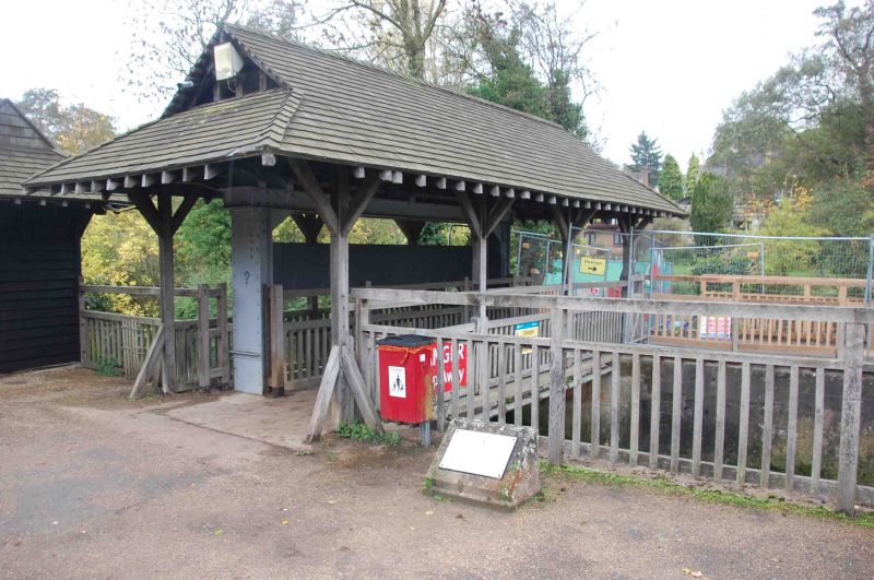
MILL LANE
1.
1485
(West Side)
Old Iffley Lock
SP 5203 NE 14/769
II
2.
The original 'pound' lock in use by 1632 and one of the first 3 locks on
the Thames. Stone retaining walls, much repaired. Modern sluice.
Listing NGR: SP5259503639
External links are from the relevant listing authority and, where applicable, Wikidata. Wikidata IDs may be related buildings as well as this specific building. If you want to add or update a link, you will need to do so by editing the Wikidata entry.


Other nearby listed buildings
