Approximate Location Map
Large Map »
Latitude: 51.7552 / 51°45'18"N
Longitude: -1.2531 / 1°15'11"W
OS Eastings: 451653
OS Northings: 206542
OS Grid: SP516065
Mapcode National: GBR 8YY.VC3
Mapcode Global: VHCXV.74DS
Plus Code: 9C3WQP4W+3Q
Entry Name: Screen Walls Number 34
Listing Date: 28 June 1972
Grade: II
Source: Historic England
Source ID: 1047233
English Heritage Legacy ID: 245576
ID on this website: 101047233
Location: Oxford, Oxfordshire, OX1
County: Oxfordshire
District: Oxford
Electoral Ward/Division: Holywell
Parish: Non Civil Parish
Built-Up Area: Oxford
Traditional County: Oxfordshire
Lieutenancy Area (Ceremonial County): Oxfordshire
Church of England Parish: Oxford St Mary the Virgin with St Cross with St Peter-in-the-East,
Church of England Diocese: Oxford
Tagged with: Wall
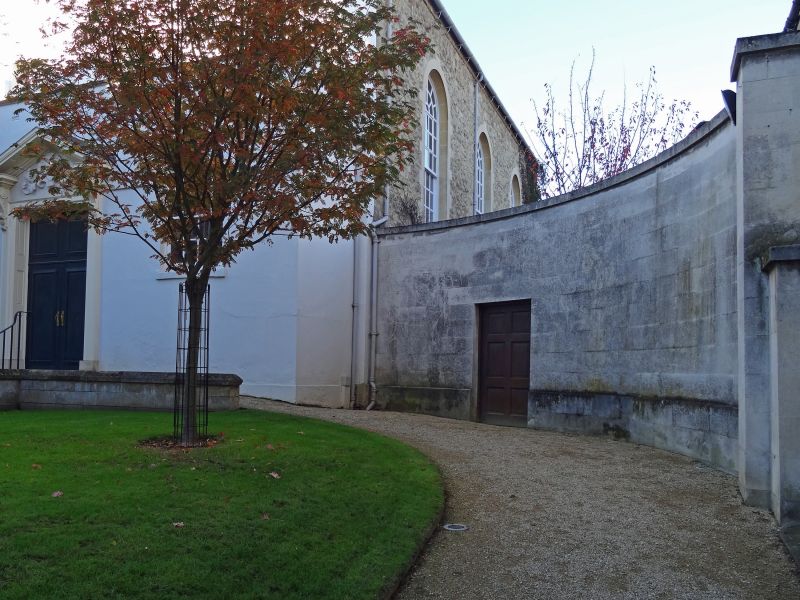
HOLYWELL STREET
1.
1485
(North Side)
Screen walls to
No 34
SP 5106 NE 6/195A
II GV
2.
C18. Curved stone wings with modern 6-panel doors on each side.
All the listed buildings on the North Side form a group.
Listing NGR: SP5165306542
External links are from the relevant listing authority and, where applicable, Wikidata. Wikidata IDs may be related buildings as well as this specific building. If you want to add or update a link, you will need to do so by editing the Wikidata entry.


Other nearby listed buildings
