Approximate Location Map
Large Map »
Latitude: 52.6341 / 52°38'2"N
Longitude: 1.2969 / 1°17'48"E
OS Eastings: 623191
OS Northings: 309145
OS Grid: TG231091
Mapcode National: GBR W9J.J0
Mapcode Global: WHMTM.W1RY
Plus Code: 9F43J7MW+MQ
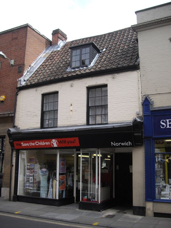
Entry Name: 21, Magdalen Street
Listing Date: 5 June 1972
Grade: II
Source: Historic England
Source ID: 1051186
English Heritage Legacy ID: 229250
ID on this website: 101051186
Location: The Close, Norwich, Norfolk, NR3
County: Norfolk
District: Norwich
Electoral Ward/Division: Mancroft
Parish: Non Civil Parish
Built-Up Area: Norwich
Traditional County: Norfolk
Lieutenancy Area (Ceremonial County): Norfolk
Church of England Parish: Norwich St George, Colegate
Church of England Diocese: Norwich
Tagged with: Building
TG 2309 SW MAGDALEN STREET
(east side)
11/484
5.6.72. No. 21
GV II
Former use unknown now shop. Cl7. Painted brick at first-floor. Pantile
roof. 2 storeys. 2 bays. C19 shopfront and yard entry to right. First
floor sash windows with glazing bars in top sash. Small dormer with case-
ment window.
Listing NGR: TG2319109144
External links are from the relevant listing authority and, where applicable, Wikidata. Wikidata IDs may be related buildings as well as this specific building. If you want to add or update a link, you will need to do so by editing the Wikidata entry.


Other nearby listed buildings
