Approximate Location Map
Large Map »
Latitude: 52.6304 / 52°37'49"N
Longitude: 1.2991 / 1°17'56"E
OS Eastings: 623359
OS Northings: 308741
OS Grid: TG233087
Mapcode National: GBR W9W.B6
Mapcode Global: WHMTM.X4SS
Plus Code: 9F43J7JX+5J
Entry Name: 28, Tombland
Listing Date: 5 June 1972
Grade: II
Source: Historic England
Source ID: 1051814
English Heritage Legacy ID: 229682
ID on this website: 101051814
Location: The Close, Norwich, Norfolk, NR3
County: Norfolk
District: Norwich
Electoral Ward/Division: Thorpe Hamlet
Parish: Non Civil Parish
Built-Up Area: Norwich
Traditional County: Norfolk
Lieutenancy Area (Ceremonial County): Norfolk
Church of England Parish: Norwich St George, Tombland
Church of England Diocese: Norwich
Tagged with: Building
TG 2308 NW TOMBLAND
(south side)
16/902
5.6.72. No. 28
GV II
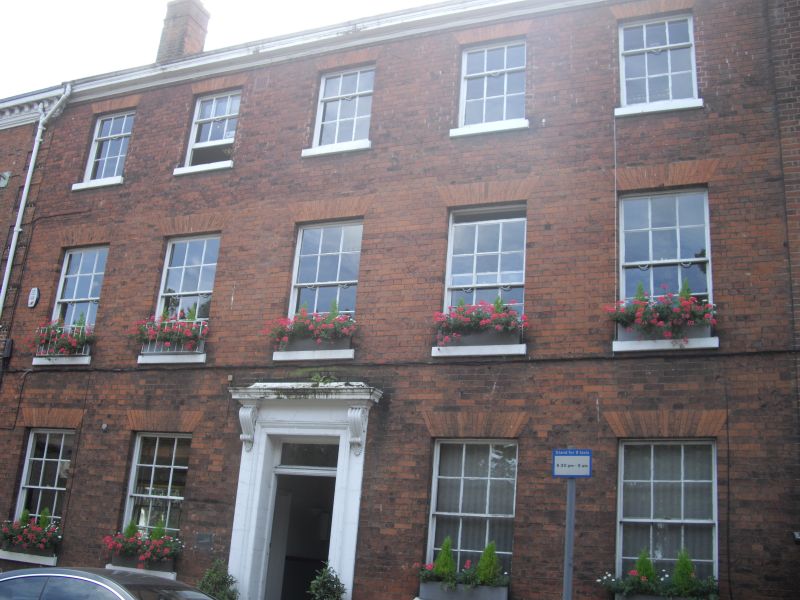
Former house now office. C18. Red brick and slate roof. 3 storeys plus
semi-basement. 5 bays. Central door with rectangular fanlight and plain
surround with small flat hood on consoles. Sash windows throughout with
glazing bars and rubbed brick flat arches. Box cornice.
Listing NGR: TG2335908741
External links are from the relevant listing authority and, where applicable, Wikidata. Wikidata IDs may be related buildings as well as this specific building. If you want to add or update a link, you will need to do so by editing the Wikidata entry.


Other nearby listed buildings
