Approximate Location Map
Large Map »
Latitude: 52.5307 / 52°31'50"N
Longitude: -2.4116 / 2°24'41"W
OS Eastings: 372174
OS Northings: 292617
OS Grid: SO721926
Mapcode National: GBR BZ.FP0F
Mapcode Global: VH90Z.4NYB
Plus Code: 9C4VGHJQ+79
Entry Name: 1 and 3 Stourbridge Road
Listing Date: 1 February 1974
Grade: II
Source: Historic England
Source ID: 1053928
English Heritage Legacy ID: 254556
ID on this website: 101053928
Location: Low Town, Shropshire, WV15
County: Shropshire
Civil Parish: Bridgnorth
Built-Up Area: Bridgnorth
Traditional County: Shropshire
Lieutenancy Area (Ceremonial County): Shropshire
Church of England Parish: Bridgnorth
Church of England Diocese: Hereford
Tagged with: Building
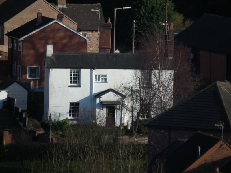
SO 79 SW
3/232
BRIDGNORTH
STOURBRIDGE ROAD
Nos 1 and 3
II
No. 1 early C19. Stucco; two storeys; two sash windows and one small modern casement window; plain doorway and gabled porch; tiles, No. 3 tied on right-hand side C16-17 of square panelled black and white timber framing; single storey plus attic; small casement windows; three gabled dormers; tiles.
Listing NGR: SO7217492617
External links are from the relevant listing authority and, where applicable, Wikidata. Wikidata IDs may be related buildings as well as this specific building. If you want to add or update a link, you will need to do so by editing the Wikidata entry.


Other nearby listed buildings
