Approximate Location Map
Large Map »
Latitude: 52.8553 / 52°51'19"N
Longitude: -2.7268 / 2°43'36"W
OS Eastings: 351155
OS Northings: 328895
OS Grid: SJ511288
Mapcode National: GBR 7J.S45B
Mapcode Global: WH8B2.2HSD
Plus Code: 9C4VV74F+47
Entry Name: 70 High Street
Listing Date: 6 June 1983
Grade: II
Source: Historic England
Source ID: 1055472
English Heritage Legacy ID: 259930
ID on this website: 101055472
Location: Wem, Shropshire, SY4
County: Shropshire
Civil Parish: Wem Urban
Built-Up Area: Wem
Traditional County: Shropshire
Lieutenancy Area (Ceremonial County): Shropshire
Church of England Parish: Wem St Peter and St Paul
Church of England Diocese: Lichfield
Tagged with: Building
SJ 5128
3/24
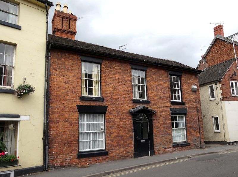
HIGH STREET (north side)
No 70
GV
II
Early C19 red brick front to timber-frame house with roughcast end wall. Plain tile roof with gabled ends. Two storeys. Three bays. Sashes with glazing bars and plain lintels. Central doorcase with moulded pilasters, broken pediment, semi-circular fanlight with radial glazing bars and glazed door.
Listing NGR: SJ5115528895
External links are from the relevant listing authority and, where applicable, Wikidata. Wikidata IDs may be related buildings as well as this specific building. If you want to add or update a link, you will need to do so by editing the Wikidata entry.


Other nearby listed buildings
