Approximate Location Map
Large Map »
Latitude: 51.0147 / 51°0'52"N
Longitude: -3.1072 / 3°6'25"W
OS Eastings: 322430
OS Northings: 124509
OS Grid: ST224245
Mapcode National: GBR M1.J6NQ
Mapcode Global: FRA 46CF.KBS
Plus Code: 9C3R2V7V+V4
Entry Name: Ivor House
Listing Date: 4 July 1975
Grade: II
Source: Historic England
Source ID: 1059941
English Heritage Legacy ID: 269922
ID on this website: 101059941
Location: Taunton, Somerset, TA1
County: Somerset
District: Somerset West and Taunton
Electoral Ward/Division: Taunton Manor and Wilton
Parish: Non Civil Parish
Built-Up Area: Taunton
Traditional County: Somerset
Lieutenancy Area (Ceremonial County): Somerset
Tagged with: House
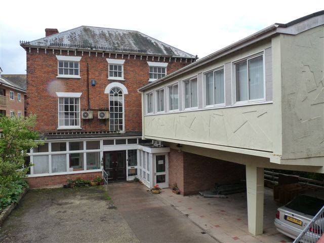
1. TOWER LANE
5365
(North Side)
Ivor House
ST 2224 NW 8/395
II GV
2.
Mid C19, much altered. 3 sotreys. Main (east) front partly submerged by modern
extensions. Red brick. Hipped slate roof, projecting eaves with curved brackets.
3 windows with painted voussoirs. Central window on 1st floor with round head.
Sashes with glazing bars. Ground floor now obscured.
Ivor House forms a group with No 3 Tower Lane.
Listing NGR: ST2243024509
External links are from the relevant listing authority and, where applicable, Wikidata. Wikidata IDs may be related buildings as well as this specific building. If you want to add or update a link, you will need to do so by editing the Wikidata entry.


Other nearby listed buildings
