Approximate Location Map
Large Map »
Latitude: 51.0122 / 51°0'43"N
Longitude: -3.1084 / 3°6'30"W
OS Eastings: 322342
OS Northings: 124228
OS Grid: ST223242
Mapcode National: GBR M1.JDBN
Mapcode Global: FRA 46CF.QW8
Plus Code: 9C3R2V6R+VM
Entry Name: 4 and 5
Listing Date: 4 July 1975
Grade: II
Source: Historic England
Source ID: 1059960
English Heritage Legacy ID: 269868
ID on this website: 101059960
Location: Taunton, Somerset, TA1
County: Somerset
District: Somerset West and Taunton
Electoral Ward/Division: Taunton Manor and Wilton
Parish: Non Civil Parish
Built-Up Area: Taunton
Traditional County: Somerset
Lieutenancy Area (Ceremonial County): Somerset
Tagged with: Building
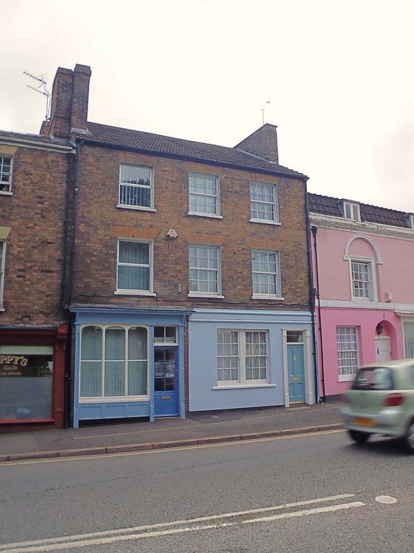
1. SHUTTERN
5365
(South Side)
Nos 4 & 5
ST 2224 SW 10/346
II GV
2.
One building. Mid/late C19. 3 storeys. Brown brick. Pantile roof, a windows,
Sashes with glazing bars. Contemporary shop front to No 4 with original glazing
divisions. Modern shop front to No 5. Included for group value.
Nos 1 to 6 (consec) form a group.
Listing NGR: ST2234224228
External links are from the relevant listing authority and, where applicable, Wikidata. Wikidata IDs may be related buildings as well as this specific building. If you want to add or update a link, you will need to do so by editing the Wikidata entry.


Other nearby listed buildings
