Approximate Location Map
Large Map »
Latitude: 51.0142 / 51°0'51"N
Longitude: -3.1049 / 3°6'17"W
OS Eastings: 322587
OS Northings: 124453
OS Grid: ST225244
Mapcode National: GBR M1.JF6M
Mapcode Global: FRA 46DF.L6M
Plus Code: 9C3R2V7W+M2
Entry Name: 22-25, Bath Place
Listing Date: 4 July 1975
Grade: II
Source: Historic England
Source ID: 1060065
English Heritage Legacy ID: 269626
ID on this website: 101060065
Location: Taunton, Somerset, TA1
County: Somerset
District: Somerset West and Taunton
Electoral Ward/Division: Taunton Manor and Wilton
Parish: Non Civil Parish
Built-Up Area: Taunton
Traditional County: Somerset
Lieutenancy Area (Ceremonial County): Somerset
Tagged with: Building
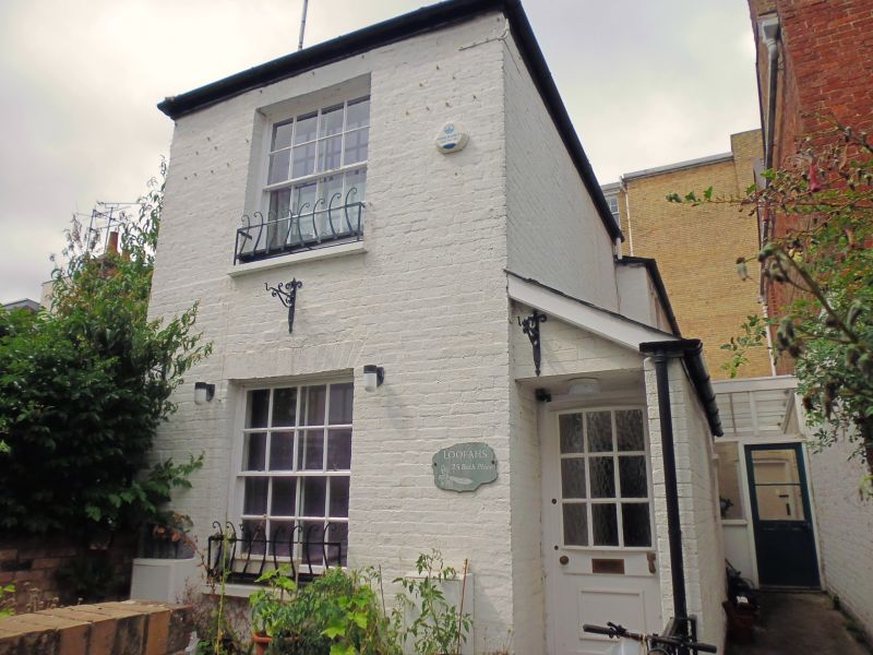
BATH PLACE
5365
(North Side)
Nos 22 to 25 (consec)
ST 2224 SE 11/169
II GV
2.
Mid/late C19. Row of brick cottages with end to right (whitewashed) returned
forward. No 23 breaks forward slightly. 2 storeys. Slate roofs. Stringcourse
with bricks set diagonally. 6 windows to row and 1 window to right hand section.
Sashes with glazing bars. Wooden porches over entrances to Nos 22 to 24 (consec).
Entrance to No 25 to right hand side. Included as a group.
All the listed buildings (except No 14 and the Dragon Book Shop and Wall) in Bath Place
and Corporation Street form a group.
Listing NGR: ST2259224454
External links are from the relevant listing authority and, where applicable, Wikidata. Wikidata IDs may be related buildings as well as this specific building. If you want to add or update a link, you will need to do so by editing the Wikidata entry.


Other nearby listed buildings
