Approximate Location Map
Large Map »
Latitude: 51.3412 / 51°20'28"N
Longitude: 0.7537 / 0°45'13"E
OS Eastings: 591888
OS Northings: 163835
OS Grid: TQ918638
Mapcode National: GBR RT6.Z85
Mapcode Global: VHKJM.0KS6
Plus Code: 9F328QR3+FF
Entry Name: Murston House
Listing Date: 13 December 1974
Grade: II
Source: Historic England
Source ID: 1061037
English Heritage Legacy ID: 175809
ID on this website: 101061037
Location: Snipeshill, Swale, Kent, ME10
County: Kent
District: Swale
Electoral Ward/Division: Murston
Parish: Non Civil Parish
Built-Up Area: Sittingbourne
Traditional County: Kent
Lieutenancy Area (Ceremonial County): Kent
Tagged with: House
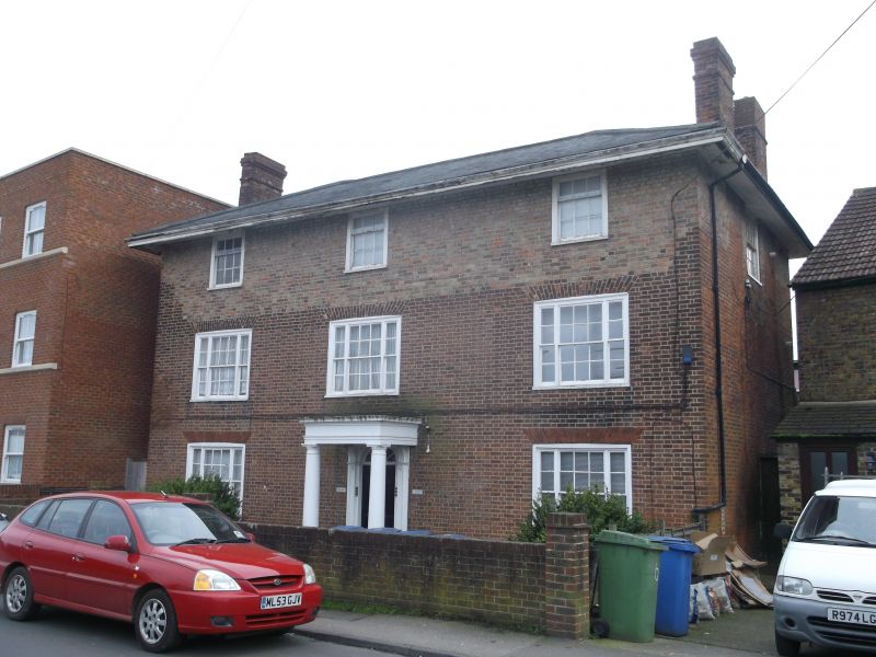
1.
5282 TONGE ROAD
(South Side)
MURSTON
Murston House
TQ 96 SW 9/160
II
2.
Mid C19. 3 storeys, the ground and 1st floors are of red brick but a 2nd storey
in yellow brick has been added. Hipped slate roof. 3 sashes. These are 3-light
with cambered heads to the lower floors. Tuscan porch. Semi-circular fanlight
and 6 panelled door.
Listing NGR: TQ9188863835
External links are from the relevant listing authority and, where applicable, Wikidata. Wikidata IDs may be related buildings as well as this specific building. If you want to add or update a link, you will need to do so by editing the Wikidata entry.


Other nearby listed buildings
