Approximate Location Map
Large Map »
Latitude: 51.3489 / 51°20'56"N
Longitude: 0.7326 / 0°43'57"E
OS Eastings: 590392
OS Northings: 164639
OS Grid: TQ903646
Mapcode National: GBR RT6.635
Mapcode Global: VHKJL.NC58
Plus Code: 9F328PXM+H3
Entry Name: 74 and 76, High Street
Listing Date: 13 December 1974
Grade: II
Source: Historic England
Source ID: 1061057
English Heritage Legacy ID: 175757
ID on this website: 101061057
Location: Milton Regis, Swale, Kent, ME10
County: Kent
District: Swale
Electoral Ward/Division: Milton Regis
Parish: Non Civil Parish
Built-Up Area: Sittingbourne
Traditional County: Kent
Lieutenancy Area (Ceremonial County): Kent
Tagged with: Building
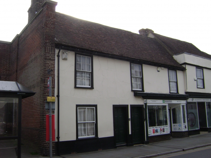
1.
5282 HIGH SWEET
(East Side)
MILTON REGIS
Nos 74 and 76
TQ 9064 NW 1/75
II GV
2.
C18 pair. 2 storeys stuccoed. Tiled roof. 3 sashes with glazing bars intact
on the 1st floor only. No 74 has a modern shop front.
Nos 52 to 76 (even), 80 to 104 (even), 104A and 110 form a group.
Listing NGR: TQ9039264639
External links are from the relevant listing authority and, where applicable, Wikidata. Wikidata IDs may be related buildings as well as this specific building. If you want to add or update a link, you will need to do so by editing the Wikidata entry.


Other nearby listed buildings
