Approximate Location Map
Large Map »
Latitude: 53.3673 / 53°22'2"N
Longitude: -0.0029 / 0°0'10"W
OS Eastings: 532977
OS Northings: 387464
OS Grid: TF329874
Mapcode National: GBR XYFH.5M
Mapcode Global: WHHJS.XMSD
Plus Code: 9C5X9X8W+WR
Entry Name: 71 and 73, Eastgate
Listing Date: 18 February 1974
Grade: II
Source: Historic England
Source ID: 1063260
English Heritage Legacy ID: 194947
ID on this website: 101063260
Location: Louth, East Lindsey, Lincolnshire, LN11
County: Lincolnshire
District: East Lindsey
Civil Parish: Louth
Built-Up Area: Louth
Traditional County: Lincolnshire
Lieutenancy Area (Ceremonial County): Lincolnshire
Church of England Parish: Louth
Church of England Diocese: Lincoln
Tagged with: Building
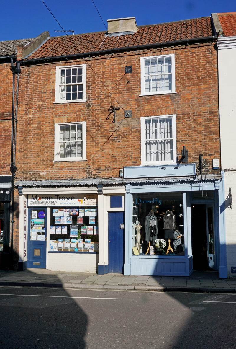
EASTGATE
1.
1348
(North Side)
TF 38 NW 1/171 Nos 71 & 73
II GV
II
Late C18. 3 storeys in brick. Pantile roof. 2 windows, sliding sashes
with glazing bars; hung sashes with glazing bars on 1st floor. 2 late Cl9
and modern shop fronts.
Nos 57 to 75 (odd), Nos 79 to 103 (odd) with No 2 Vickers Lane form a group.
Listing NGR: TF3297787464
External links are from the relevant listing authority and, where applicable, Wikidata. Wikidata IDs may be related buildings as well as this specific building. If you want to add or update a link, you will need to do so by editing the Wikidata entry.


Other nearby listed buildings
